Showing below up to 50 results in range #1 to #50.
- 120515 wrakkenposter Noordzee A3 Engelse versie.png 2,384 × 3,370; 2.04 MB
- 640x427-white-beaked-dolphin.jpg 800 × 534; 20 KB
- AS coastal municipalities.png 2,117 × 1,379; 482 KB
- Ais tracks marine traffic google NorthSEE proto.jpg 510 × 649; 220 KB
- Aquaculture.png 64 × 64; 3 KB
- Atlantic Mackerel NOAA.png 800 × 534; 183 KB
- Atlantic herring - clupea harengus - haring.png 4,000 × 1,756; 2.49 MB
- Atlantic mackerel - scomber scombrus - makreel.png 4,000 × 1,846; 1.88 MB
- BS EEZ.png 1,194 × 1,005; 782 KB
- BS bottom temperature.png 1,920 × 1,080; 1.16 MB
- Bathymetry.png 1,565 × 947; 845 KB
- Birds and mammals.png 64 × 64; 3 KB
- Blue mussels.jpg 474 × 355; 67 KB
- Bottom-Trawl.png 500 × 350; 40 KB
- Cables and pipelines.png 64 × 64; 4 KB
- Common sole - solea solea - tong.png 4,000 × 2,675; 5.75 MB
- Country info BS.png 1,920 × 1,079; 1.42 MB
- CruiseShip.jpg 960 × 638; 165 KB
- Dog fish NOAA.png 800 × 534; 102 KB
- Energy.png 64 × 64; 3 KB
- Environmental conditions.png 64 × 64; 3 KB
- European plaice - pleuronectes platessa - schol.png 4,000 × 2,668; 3.47 MB
- FerryShip.jpg 960 × 720; 176 KB
- Fish.png 64 × 64; 3 KB
- Fishing.png 64 × 64; 3 KB
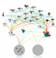
- Food web2.png 2,271 × 2,341; 1.63 MB
- Global Icon.png 75 × 75; 6 KB
- Governance.png 64 × 64; 2 KB
- Grey gurnard - eutrigla gernardus - grauwe poon.png 4,000 × 2,385; 2.7 MB
- Grey seal - halichoercus grypus - grijze zeehond.png 4,000 × 2,665; 2.35 MB
- Helicopter Platforms.jpg 1,184 × 720; 248 KB
- HorseMussel.jpg 1,600 × 1,063; 427 KB
- HorseMusselBed.jpg 1,600 × 1,067; 700 KB
- ICES rect.png 1,414 × 942; 1,008 KB
- Kayak Example.jpg 960 × 590; 136 KB
- Layer Active Demersal Catch.png 1,843 × 1,161; 1.75 MB
- Layer Anchorages.png 400 × 260; 207 KB
- Layer Aquaculture.png 400 × 261; 157 KB
- Layer Bathing Sites.png 1,273 × 1,008; 1.29 MB
- Layer Bathymetry.png 512 × 384; 255 KB
- Layer Bottom Trawl Catch.png 890 × 620; 229 KB
- Layer Cargo Intensity.png 642 × 408; 540 KB
- Layer Cities.png 2,302 × 1,437; 500 KB
- Layer Coastal Municipalities.png 2,117 × 1,379; 482 KB
- Layer Coastal Regions.png 2,303 × 1,440; 541 KB
- Layer Cod.png 4,000 × 1,600; 2.91 MB
- Layer Converter Station.jpeg 675 × 380; 43 KB
- Layer Countries.png 1,286 × 1,600; 1.16 MB
- Layer Currents Speed.png 1,443 × 1,268; 1.57 MB
- Layer Demersal fish.jpg 800 × 534; 41 KB


 Co-funded by the European Union.