Showing below up to 50 results in range #101 to #150.
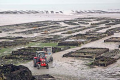 Layer Shellfish Farms.png 400 × 266; 210 KB
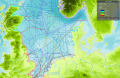
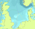
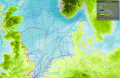 Layer Shipping Intensity.png 635 × 412; 576 KB
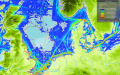 Layer Shipping Intensity Cargo(static).png 1,262 × 786; 1.78 MB
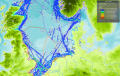 Layer Shipping Intensity Passenger (static).png 1,345 × 856; 1.84 MB
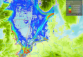 Layer Shipping Intensity Tanker(static).png 1,218 × 830; 1.77 MB
 Layer Shipping Risk.png 636 × 412; 605 KB
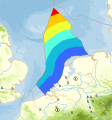
 Layer Sprat Biomass.jpg 1,200 × 394; 96 KB
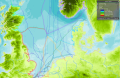 Layer Tanker Intensity.png 636 × 411; 535 KB
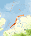
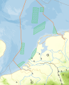
 Layer Territorial Waters.png 1,727 × 1,101; 1.47 MB
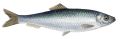
 Layer Whiting.jpeg 1,200 × 600; 180 KB
 Layer Wreckages.png 1,480 × 1,130; 1.88 MB
- MSP Challenge Baltic.mp4 ; 16.35 MB
 MSP Logo Adriatic.png 930 × 930; 54 KB
 MSP Logo Baltic.png 930 × 930; 31 KB
 MSP Logo Clyde.png 930 × 930; 34 KB
 MSP Logo General.png 300 × 300; 27 KB
 MSP Logo NorthSea.png 930 × 930; 31 KB
 Mackerel Example.jpg 800 × 575; 83 KB
 Macrobenthos.png 64 × 64; 4 KB
 Mineable.png 1,065 × 1,261; 520 KB
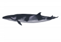 Minke whales - balaenoptera acutorostrata - dwergvinvis.png 4,000 × 2,726; 1.02 MB
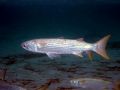 Mullets.jpeg 640 × 480; 112 KB
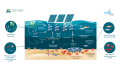 MultipurposePlatform.png 1,920 × 1,080; 694 KB
 Mussel bed sciencelearn.jpg 504 × 336; 48 KB
 NSBrown.png 946 × 822; 168 KB
 NS -20 line.png 1,199 × 1,357; 330 KB
 NS Abandoned OR.png 1,015 × 1,150; 355 KB
 NS Approach OR.png 766 × 1,051; 239 KB
 NS Bottom Trawl Flow.png 1,426 × 861; 84 KB
 NS Coastal Foundation OR.png 1,392 × 1,217; 123 KB
 NS DistancetoCoast.png 924 × 992; 400 KB
 NS EEZ Example.png 1,559 × 1,312; 802 KB
 NS Ecologic Value OR.png 949 × 1,178; 343 KB
 NS Erosion trend.png 1,154 × 1,084; 174 KB
 NS Flow Diagram.png 1,427 × 861; 81 KB
 NS Hooks Flow.png 1,433 × 865; 84 KB
 NS Industrial Trawl Flow.png 1,432 × 865; 80 KB
 NS Licensed Area OR.png 916 × 912; 305 KB
 NS Mackerel Flow.png 1,421 × 843; 84 KB
 NS Nets Flow.png 1,434 × 865; 85 KB
 NS Reservation OR.png 1,205 × 1,036; 485 KB
 NS Search AReas OR.png 942 × 1,212; 293 KB
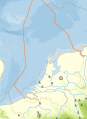
 NS Territorial Waters Example.png 1,222 × 877; 336 KB
 NS Tidal Excursion OR.png 1,034 × 956; 395 KB
 NS coast line reference.png 1,505 × 1,006; 399 KB
 NS criticalsandpitdepth.png 1,067 × 954; 480 KB
 NS oil gas availability.PNG 1,677 × 1,147; 1.93 MB
 NS sand type.png 1,115 × 1,334; 346 KB
 NS sholow.png 881 × 1,061; 357 KB
 Natura 2000.png 1,200 × 854; 86 KB


.png)
.png)
.png)


 Co-funded by the European Union.