Showing below up to 50 results in range #251 to #300.
- Layer Surface Disturbance.png
- Layer AIS Fishing Intensity.png
- LayerType 400MW.png
- Layer Protection Pots and Creels.png
- LayerType Moderate.png
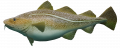
- Layer Sharks.png
- LayerType Passive Demersal Fleet Protection.png
- Layer Unesco Sites.png
- Layer Artificial Substrate.png
- LayerType 2035.png
- Wikimedia-logo.svg
- Layer Rowing.png
- LayerType No pots and creel fishing.png
- Layer Wind Density.png
- Layer Populated Places.png
- LayerType Pelagic Fleet Protection.png
- Layer Automated Vessel Intensity.png
- LayerType 2040.png
- Layer Interconnectors (electricity).png
- LayerType Closed.png
- Layer Shipping Recreation Total.png
- Layer Wind Farms.png
- Layer Boating Clubs.png
- LayerType 150MW.png
- Layer Fairways.png
- Layer Gates.png
- Layer Walking.png
- LayerType 2045.png
- LayerType No protection.png
- LayerType Purple.png
- Layer Bottom Disturbance.png
- LayerType 300MW.png
- LayerType Active Demersal Fleet Protection.png
- Layer Potential Cables (RI.SE).png


 Co-funded by the European Union.
.png)
.png)