Showing below up to 289 results in range #1 to #289.

- Test Template Info-Icon - Version (2).svg
- LayerType High.png
- LayerType Medium.png
- LayerType Low.png
- LayerType Extra High.png
- LayerType Extreme.png
- LayerType Extremely Low.png
- Ambox warning orange.svg
- Padlock.svg
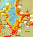
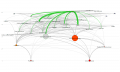
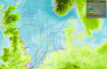
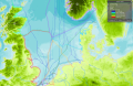
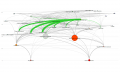
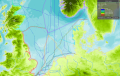
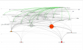
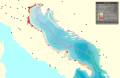
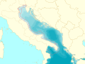
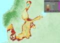
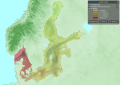
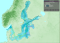
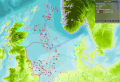
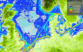
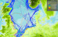
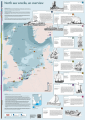
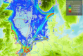
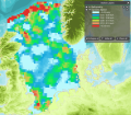
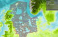
 Snapshot-of-Vessel-Traffic-in-the-North-Sea-area-showing-AIS-based-indication-of-traffic.jpg.png Used on 12 pages
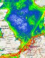
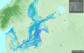
502 × 373; 322 KB
- LayerType Tanker.png

- LayerType Very high density.png
- LayerType High density.png
- LayerType Very low density.png
- LayerType Cargo.png
- LayerType Medium density.png
- LayerType Low density.png
- LayerType Passenger.png
- LayerType Very high.png
- LayerType Very low.png
- LayerType Very High.png
- LayerType 500 to 1.000 ships.png

- LayerType 100 - 200.png
- LayerType 300 - 400.png
- LayerType 0 - 100.png
- LayerType 1.000 to 5.000 ships.png
- LayerType 200 - 300.png
- LayerType Orange.png
- Edit-copy green.svg
- LayerType more than 20.000 ships.png
- LayerType 0 to 500 ships.png
- LayerType 500+.png
- LayerType 10.000 to 20.000 ships.png
- Ambox important.svg
- Lua-logo-nolabel.svg
- LayerType 400 - 500.png

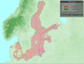
- Layer Marine Protected Areas.png
- LayerType Blue.png
- LayerType Operational.png
- Flag of the United States.svg

- LayerType 5-6 m/s.png
- LayerType Red.png
- LayerType 5.000 to 10.000 ships.png
- LayerType Automated Vessels.png
- LayerType 4-5 m/s.png
- LayerType Others.png
- LayerType 6-7 m/s.png

- LayerType 3-4 m/s.png

- LayerType Maintenance.png
- Wikidata-logo.svg


- LayerType Good.png
- LayerType High probability.png
- Commons-logo.svg
- LayerType Pink.png
- Flag of Spain.svg
- Layer Landing Stations.png
- LayerType Lime.png

- LayerType Recreational.png
- LayerType 7-8 m/s.png
- Layer Topography.png
- LayerType Planned.png

- USS Wisconsin (BB-64) underway at sea, circa 1988-1991 (NH 97206-KN).jpgUSS Wisconsin (BB-64) underway at sea, circa 1988-1991 (NH 97206-KN).jpg Used on 3 pages
File missing
- LayerType Green.png
- Layer Pipelines.png
- LayerType 0 m.png
- US flag 48 stars.svg
- Layer No Shipping Zones.png
- Uss bang.jpg
- Uss west virginia bb.jpg
- Layer Noise.png
- Layer Energy Cables.png
- Wikibooks-logo-en-noslogan.svg
- LayerType Low probability.png
- Wikidata-favicon.png
- Ambox warning yellow.svg
- Layer Water Quality.png
- Layer Automated Vessel Intensity.png
- LayerType 2040.png

- LayerType Pelagic Fleet Protection.png
- Layer Boating Clubs.png
- Layer Interconnectors (electricity).png
- LayerType Closed.png
- Layer Oil & Gas Licensed Areas.png
- Layer Telecom Cables.png
- LayerType 150MW.png
- Layer Fairways.png
- Layer Sensitive seabed habitats.png
- LayerType 2045.png
- Layer Gates.png
- LayerType Purple.png
- Layer Bottom Disturbance.png
- LayerType 300MW.png
- Wikimedia-logo.svg
- Layer Oil & Gas Safety Zones.png
- LayerType No protection.png
- LayerType Active Demersal Fleet Protection.png
- Layer Protection Active Demersal.png
- LayerType 1.000MW.png
- LayerType 2050.png
- Layer Converter Station.png
- Layer General Boating Areas.png
- Layer Recreational Boating Intensity.png
- Layer Significant Marine Areas (EBSA).png
- LayerType 6MW Floating Wind.png
- LayerType No protection against fishing.png
- Layer Sandeel.png
- Layer Tidal Farms.png
- Layer AIS Total Shipping Intensity.png
- Layer Wave Farms.png
- LayerType 50MW.png
- Layer Harbours Area.png
- Image is needed male.svg
- Layer Oil and Gas Terminals .png
- Layer Scuba Diving.png
- LayerType 460MW.png
- Layer Military Areas.png
- Layer Protection Nephrops Fleet.png
- Information icon4.svg
- Layer Wind Speed.png
- LayerType 100 m.png
- Layer Large Fish Indicator.png
- LayerType No scallops fishing.png
- Layer Sea Angling from Boats.png
- Layer Fisheries Closure.png
- Layer Protection Passive Demersal.png
- No such image
- Layer Wind Surfing.png
- LayerType No seine fishing.png
- Layer Sea Angling from Shore.png
- Layer Protection Pelagic.png
- LayerType Poor.png
- Layer Shipping Intensity Total.png
- LayerType 10.000MW.png
- Abbey Rd Studios.jpg
- Layer Surface Disturbance.png
- LayerType Yellow.png
- Layer Cables (non-editable).png
- Layer Transmission Lines (Land Grid).png
- LayerType 200 m.png
- Layer Cod Fisheries Closure.png
- LayerType Bad.png
- Layer Protection Pots and Creels.png
- Layer Sharks.png
- LayerType Unused.png
- Layer Whiting.png
- Layer Bird Watching.png
- Layer Rowing.png
- Layer Cables Other.png
- Layer Populated Places.png
- Bilbao.svg
- Layer Unesco Sites.png
- LayerType 2025.png
- Layer Fishing Intensity.png
- Layer Natura 2000.png
- Layer Shipping Recreation Total.png
- Layer Wind Density.png
- Layer Birds.png
- LayerType No demersal fishing.png
- Layer Canoeing.png
- LayerType 800MW.png
- LayerType 2030.png
- Layer Wind Farms.png
- LayerType 25MW.png
- LayerType No nephrops fishing.png
- Layer AIS Fishing Intensity.png
- LayerType 400MW.png
- Layer Energy Transformers (Land Grid).png
- LayerType 80MW.png
- Layer Potential Cables (RI.SE).png
- Example-serious.jpg
- Layer Walking.png
- Layer Artificial Substrate.png
- LayerType 2035.png
- Layer Protection Seine.png
- LayerType Moderate.png
- LayerType Passive Demersal Fleet Protection.png
- LayerType No pots and creel fishing.png
- Layer Sediments.png


.png)


.png)


.png)


 Co-funded by the European Union.
.svg)
_underway_at_sea,_circa_1988-1991_(NH_97206-KN).jpg)
.png)
.png)
.png)
.png)
.png)
.png)