Showing below up to 43 results in range #121 to #163.
 NS oil gas availability.PNG 1,677 × 1,147; 1.93 MB
 Natura 2000.png 1,200 × 854; 86 KB
- Natura 2000 Example.webm ; 590 KB
 Natural resources.png 64 × 64; 3 KB
 Nets.png 675 × 474; 303 KB
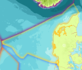
 Ns country blue.png 816 × 652; 225 KB
 Ns country navy.png 214 × 207; 41 KB
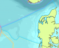
 Ns country yellow.png 879 × 750; 342 KB
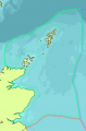
 Nsblue.png 491 × 402; 79 KB
 Nsgreen.png 482 × 734; 100 KB
 Nslime.png 93 × 100; 9 KB
 Nsorange.png 405 × 621; 87 KB
 Nspink.png 105 × 127; 12 KB
 Nspurple.png 628 × 753; 149 KB
 Nsred.png 429 × 803; 113 KB
 Nsyellow.png 457 × 393; 68 KB
 Passive Demersal.png 1,900 × 1,204; 1.89 MB
 Passive Demersal Fleet.png 200 × 134; 15 KB
 Poster safe shipping NorthSEE draft.png 2,179 × 1,156; 1.39 MB
 Pots Creel.jpg 912 × 513; 95 KB
 Pressures.png 64 × 64; 3 KB
 Protected areas.png 64 × 64; 3 KB
 Recreational.png 64 × 64; 4 KB
 Restrictions Icon.png 82 × 82; 3 KB
 Routing North Sea NorthSEE.png 1,600 × 912; 2.19 MB
 Sandeels - genus ammodytes - ammodytes.png 4,000 × 2,000; 1.19 MB
 Scallop dredge.png 1,000 × 735; 848 KB
 Scomber scombrus.png 248 × 150; 30 KB
 Seine Fleet.png 1,024 × 768; 768 KB
 Ship Example.jpg 960 × 677; 217 KB
 Shipping.png 64 × 64; 3 KB
 Snapshot traffic Channel and western NorthSEE.jpg 801 × 1,138; 264 KB
 TSS Example.png 700 × 283; 39 KB
 Template Icon.png 80 × 80; 2 KB
 Territorial Sea.jpg 602 × 323; 55 KB
 The Marine Spatial Planning Directive.jpeg 875 × 1,241; 123 KB
 Traffic ACCEAS.jpg 359 × 407; 86 KB
- Waverly.webm ; 1.4 MB
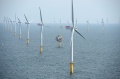 Wind Farm Example.jpg 1,200 × 792; 232 KB
- Wind Farm Example.webm ; 633 KB
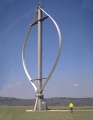 Wind Turbine Example X.jpeg 600 × 773; 176 KB
- Wrecks6.webm ; 5 MB


 Co-funded by the European Union.