Showing below up to 163 results in range #1 to #163.
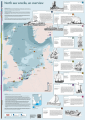 120515 wrakkenposter Noordzee A3 Engelse versie.png 2,384 × 3,370; 2.04 MB
 640x427-white-beaked-dolphin.jpg 800 × 534; 20 KB
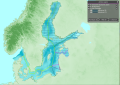
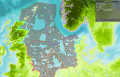
 AS coastal municipalities.png 2,117 × 1,379; 482 KB
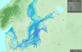
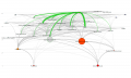
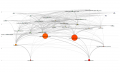
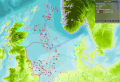
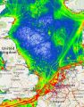 Ais tracks marine traffic google NorthSEE proto.jpg 510 × 649; 220 KB
 Aquaculture.png 64 × 64; 3 KB
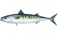
 Atlantic Mackerel NOAA.png 800 × 534; 183 KB
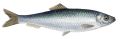
 Atlantic herring - clupea harengus - haring.png 4,000 × 1,756; 2.49 MB
 Atlantic mackerel - scomber scombrus - makreel.png 4,000 × 1,846; 1.88 MB
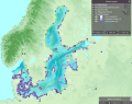
 BS EEZ.png 1,194 × 1,005; 782 KB
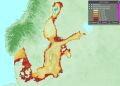
 BS bottom temperature.png 1,920 × 1,080; 1.16 MB
 Bathymetry.png 1,565 × 947; 845 KB
 Birds and mammals.png 64 × 64; 3 KB
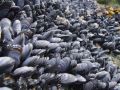 Blue mussels.jpg 474 × 355; 67 KB
 Bottom-Trawl.png 500 × 350; 40 KB
 Cables and pipelines.png 64 × 64; 4 KB
 Common sole - solea solea - tong.png 4,000 × 2,675; 5.75 MB
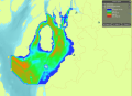
 Country info BS.png 1,920 × 1,079; 1.42 MB
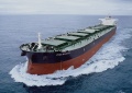
 CruiseShip.jpg 960 × 638; 165 KB
 Dog fish NOAA.png 800 × 534; 102 KB
 Energy.png 64 × 64; 3 KB
 Environmental conditions.png 64 × 64; 3 KB
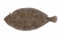
 European plaice - pleuronectes platessa - schol.png 4,000 × 2,668; 3.47 MB
 FerryShip.jpg 960 × 720; 176 KB
 Fish.png 64 × 64; 3 KB
 Fishing.png 64 × 64; 3 KB
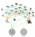 Food web2.png 2,271 × 2,341; 1.63 MB
 Global Icon.png 75 × 75; 6 KB
 Governance.png 64 × 64; 2 KB
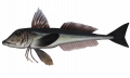 Grey gurnard - eutrigla gernardus - grauwe poon.png 4,000 × 2,385; 2.7 MB
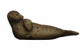 Grey seal - halichoercus grypus - grijze zeehond.png 4,000 × 2,665; 2.35 MB
 HorseMussel.jpg 1,600 × 1,063; 427 KB
 HorseMusselBed.jpg 1,600 × 1,067; 700 KB
 ICES rect.png 1,414 × 942; 1,008 KB
 Kayak Example.jpg 960 × 590; 136 KB
 Layer Active Demersal Catch.png 1,843 × 1,161; 1.75 MB
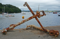 Layer Anchorages.png 400 × 260; 207 KB
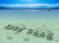
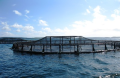 Layer Aquaculture.png 400 × 261; 157 KB
 Layer Bathing Sites.png 1,273 × 1,008; 1.29 MB
 Layer Bathymetry.png 512 × 384; 255 KB
 Layer Bottom Trawl Catch.png 890 × 620; 229 KB
 Layer Cargo Intensity.png 642 × 408; 540 KB
 Layer Cities.png 2,302 × 1,437; 500 KB
 Layer Coastal Municipalities.png 2,117 × 1,379; 482 KB
 Layer Coastal Regions.png 2,303 × 1,440; 541 KB
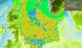
 Layer Cod.png 4,000 × 1,600; 2.91 MB
 Layer Countries.png 1,286 × 1,600; 1.16 MB
 Layer Currents Speed.png 1,443 × 1,268; 1.57 MB
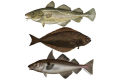
 Layer Demersal fish.jpg 800 × 534; 41 KB
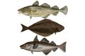
 Layer Demersal fish.png 800 × 534; 293 KB
 Layer Dredging Sites.png 1,800 × 1,164; 1.9 MB
 Layer Dumping areas.png 1,543 × 1,080; 1.33 MB
 Layer EEZ.png 1,516 × 1,057; 1.04 MB
 Layer Eutrophication Status.png 1,085 × 820; 718 KB
 Layer Exclusive Economic Zone.png 3,333 × 1,667; 740 KB
 Layer Ferry Intensity.png 638 × 410; 458 KB
 Layer Fishing Intensity.JPG 1,758 × 1,001; 193 KB
 Layer Fishing restrictions.png 2,122 × 1,295; 710 KB
 Layer Flatfish.png 800 × 534; 404 KB
 Layer Herring.png 800 × 534; 188 KB
 Layer IMO Routes.png 1,210 × 819; 726 KB
 Layer Ice Coverage.png 1,155 × 817; 907 KB
 Layer Industrial and Pelagic Trawl.png 1,108 × 770; 412 KB
 Layer Industrial and Pelagic Trawl Catch.png 1,699 × 1,007; 1.94 MB
 Layer Lighthouses.png 295 × 193; 92 KB
 Layer Local Authority Areas.png 1,592 × 1,246; 829 KB
 Layer Mackerel.png 800 × 534; 183 KB
 Layer Maintenance Intensity.png 630 × 415; 527 KB
 Layer Marinas.png 400 × 267; 145 KB
 Layer Marine reporting units.png 1,503 × 1,082; 403 KB
 Layer Maritime Compartments.png 1,609 × 1,202; 459 KB
 Layer Military areas.png 1,598 × 1,132; 1.54 MB
 Layer National Planning Areas.png 2,299 × 1,440; 885 KB
 Layer National Shipping Lanes.png 1,641 × 1,034; 1.4 MB
 Layer Nephrops Trawl Catch.png 1,461 × 535; 200 KB
 Layer No shipping zones.png 1,722 × 1,032; 976 KB
 Layer Oil & Gas Installations.png 200 × 124; 37 KB
 Layer Passenger Intensity.png 641 × 408; 544 KB
 Layer Passive Demersal Catch.png 1,900 × 1,204; 1.89 MB
 Layer Pelagic Catch.png 1,930 × 1,182; 1.84 MB
 Layer Planning Sub-areas.png 1,262 × 1,045; 205 KB
 Layer Ports.png 1,417 × 1,029; 1.24 MB
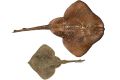 Layer Rays and Skates.jpg 800 × 534; 42 KB
 Layer Recreational Fishing.png 400 × 267; 171 KB
 Layer Recreational Interest.png 474 × 551; 574 KB
 Layer Salinity.png 1,152 × 813; 848 KB
 Layer Sand & Gravel Availability.png 1,495 × 958; 1.92 MB
 Layer Sand & Gravel Extraction.png 436 × 327; 190 KB
 Layer Scallop Fleet Catch.png 679 × 421; 124 KB
 Layer Sea Bottom Temperature.png 1,145 × 816; 838 KB
 Layer Seal.png 800 × 534; 244 KB
 Layer Seine Catch.png 1,784 × 1,296; 824 KB
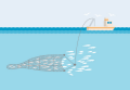
 Layer Shellfish Farms.png 400 × 266; 210 KB
 Layer Shipping Intensity.png 635 × 412; 576 KB
 Layer Shipping Intensity Cargo(static).png 1,262 × 786; 1.78 MB
 Layer Shipping Intensity Passenger (static).png 1,345 × 856; 1.84 MB
 Layer Shipping Intensity Tanker(static).png 1,218 × 830; 1.77 MB
 Layer Shipping Risk.png 636 × 412; 605 KB
 Layer Sprat Biomass.jpg 1,200 × 394; 96 KB
 Layer Tanker Intensity.png 636 × 411; 535 KB
 Layer Territorial Waters.png 1,727 × 1,101; 1.47 MB
 Layer Wreckages.png 1,480 × 1,130; 1.88 MB
- MSP Challenge Baltic.mp4 ; 16.35 MB
 MSP Logo Adriatic.png 930 × 930; 54 KB
 MSP Logo Baltic.png 930 × 930; 31 KB
 MSP Logo Clyde.png 930 × 930; 34 KB
 MSP Logo General.png 300 × 300; 27 KB
 MSP Logo NorthSea.png 930 × 930; 31 KB
 Mackerel Example.jpg 800 × 575; 83 KB
 Macrobenthos.png 64 × 64; 4 KB
 Minke whales - balaenoptera acutorostrata - dwergvinvis.png 4,000 × 2,726; 1.02 MB
 Mussel bed sciencelearn.jpg 504 × 336; 48 KB
 NSBrown.png 946 × 822; 168 KB
 NS Bottom Trawl Flow.png 1,426 × 861; 84 KB
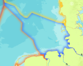
 NS EEZ Example.png 1,559 × 1,312; 802 KB
 NS Flow Diagram.png 1,427 × 861; 81 KB
 NS Hooks Flow.png 1,433 × 865; 84 KB
 NS Industrial Trawl Flow.png 1,432 × 865; 80 KB
 NS Mackerel Flow.png 1,421 × 843; 84 KB
 NS Nets Flow.png 1,434 × 865; 85 KB
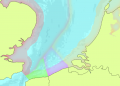 NS Territorial Waters Example.png 1,222 × 877; 336 KB
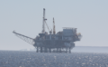
 NS oil gas availability.PNG 1,677 × 1,147; 1.93 MB
 Natura 2000.png 1,200 × 854; 86 KB
- Natura 2000 Example.webm ; 590 KB
 Natural resources.png 64 × 64; 3 KB
 Nets.png 675 × 474; 303 KB
 Ns country blue.png 816 × 652; 225 KB
 Ns country navy.png 214 × 207; 41 KB
 Ns country yellow.png 879 × 750; 342 KB
 Nsblue.png 491 × 402; 79 KB
 Nsgreen.png 482 × 734; 100 KB
 Nslime.png 93 × 100; 9 KB
 Nsorange.png 405 × 621; 87 KB
 Nspink.png 105 × 127; 12 KB
 Nspurple.png 628 × 753; 149 KB
 Nsred.png 429 × 803; 113 KB
 Nsyellow.png 457 × 393; 68 KB
 Passive Demersal.png 1,900 × 1,204; 1.89 MB
 Passive Demersal Fleet.png 200 × 134; 15 KB
 Poster safe shipping NorthSEE draft.png 2,179 × 1,156; 1.39 MB
 Pots Creel.jpg 912 × 513; 95 KB
 Pressures.png 64 × 64; 3 KB
 Protected areas.png 64 × 64; 3 KB
 Recreational.png 64 × 64; 4 KB
 Restrictions Icon.png 82 × 82; 3 KB
 Routing North Sea NorthSEE.png 1,600 × 912; 2.19 MB
 Sandeels - genus ammodytes - ammodytes.png 4,000 × 2,000; 1.19 MB
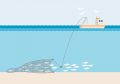
 Scallop dredge.png 1,000 × 735; 848 KB
 Scomber scombrus.png 248 × 150; 30 KB
 Seine Fleet.png 1,024 × 768; 768 KB
 Ship Example.jpg 960 × 677; 217 KB
 Shipping.png 64 × 64; 3 KB
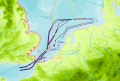
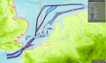
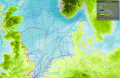
 Snapshot traffic Channel and western NorthSEE.jpg 801 × 1,138; 264 KB
 TSS Example.png 700 × 283; 39 KB
 Template Icon.png 80 × 80; 2 KB
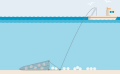
 Territorial Sea.jpg 602 × 323; 55 KB
 The Marine Spatial Planning Directive.jpeg 875 × 1,241; 123 KB
 Traffic ACCEAS.jpg 359 × 407; 86 KB
- Waverly.webm ; 1.4 MB
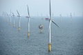 Wind Farm Example.jpg 1,200 × 792; 232 KB
- Wind Farm Example.webm ; 633 KB
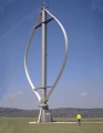 Wind Turbine Example X.jpeg 600 × 773; 176 KB
- Wrecks6.webm ; 5 MB


.png)
.png)
.png)


 Co-funded by the European Union.