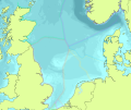
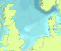
(Hillevi uploaded a new version of File:NS EEZ Example.png) |
(Hillevi reverted File:NS EEZ Example.png to an old version) |
(No difference)
| |
Latest revision as of 12:32, 10 October 2023
File history
Click on a date/time to view the file as it appeared at that time.
| Date/Time | Thumbnail | Dimensions | User | Comment | |
|---|---|---|---|---|---|
| current | 12:32, 10 October 2023 |  | 1,559 × 1,312 (802 KB) | Hillevi (talk | contribs) | Reverted to version as of 15:47, 7 March 2018 (UTC) |
| 12:31, 10 October 2023 |  | 800 × 534 (132 KB) | Hillevi (talk | contribs) | ||
| 15:47, 7 March 2018 |  | 1,559 × 1,312 (802 KB) | Mspadmin (talk | contribs) |
You cannot overwrite this file.
File usage
The following 25 pages use this file:
- (NS)EEZ
- Air Disturbance
- Benthic Producers
- Bottom Vibration
- Categories and Layers
- Coralligenous Habitats
- Create a New Page
- Desalination Plants
- Discharge Points
- Dolphins
- Energy
- Pelagic Macrofauna
- Plankton
- Preferred Cable Paths
- Protection Small-scale Coastal
- Protection Unreported Fleet
- Stratification Regime
- Treatment Plants
- Unreported Fleet Catch
- Template:Layer
- Template:Layer/Type
- NorthSea:Create a New Page
- NorthSea:EEZ
- NorthSea:Region Information
- BalticSea:Bathymetry/0 - 50 m
This page was last edited on 10 October 2023, at 12:32. Content is available under GPLv3 unless otherwise noted.
 Co-funded by the European Union.