No edit summary |
No edit summary |
||
| Line 1: | Line 1: | ||
<ul class='nav nav-tabs'> | <ul class='nav nav-tabs'> | ||
<li class='active'><btn data-toggle='tab' class=''>#tab1|General Information</btn></li> | <li class='active'><btn data-toggle='tab' class=''>#tab1|General Information</btn></li> | ||
<li><btn data-toggle='tab' class=''>#tab2|Additional Information</btn></li> | |||
</ul> | </ul> | ||
| Line 40: | Line 40: | ||
</div> | </div> | ||
<div id='tab2' class='tab-pane fade'> | <div id='tab2' class='tab-pane fade'> | ||
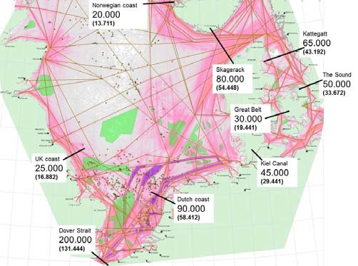
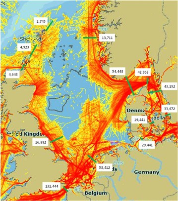
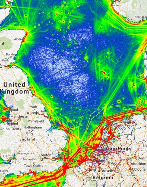
=== Different ship traffic analyses: === | |||
[[File:Snapshot-of-Vessel-Traffic-in-the-North-Sea-area-showing-AIS-based-indication-of-traffic.jpg.png|790px]] | |||
[[File:Traffic ACCEAS.jpg|790px]] | |||
[[File:Ais tracks marine traffic google NorthSEE proto.jpg|790px]] | |||
</div> | </div> | ||
Revision as of 10:38, 14 April 2018
| Layer Info | |
|---|---|
| Category | Shipping |
| Editable | No |
| Data source | Shipping simulation |
| Values | |
| Low | |
| Medium Low | |
| Medium | |
| Medium High | |
| High | |
| EXTREME | |
Description:
Shipping concerns transport by sea, involving ships or vessels transporting people (passengers) and/or goods (cargo). Shipping may be for commerce, recreation, or for military purposes. Merchant shipping is the lifeblood of the world economy, carrying 90% of international trade with 102,194 commercial ships worldwide.
MSP Challenge 2050:
Shipping Intensity is a month-by-month, computer generated data layer showing a 'heat map' of all ship traffic combined. The layer combines the tanker, cargo, passenger and ferry intensity heat maps together. Therefore this layer provides a complete overview of all simulated ship traffic within as well as in and out of the North Sea region.
The shipping simulation follows this logic:
- Month by month, tanker, cargo, passenger and ferry ships want to go from specific ports to specific ports, within as well as in and out of the North Sea region.
- These ships find a safe yet short route for their travels. Ideally they move in a straight line. To ensure the route is safe, they will opt for deeper waters and designated shipping lanes applicable to their type.
- More ships following the same route means a higher intensity of ships that month, and thus redder lines on the intensity 'heat map' layers.
ON THIS TAB VISUAL CONTENT IS PLACED
This page was last edited on 14 April 2018, at 10:38. Content is available under GPLv3 unless otherwise noted.


 Co-funded by the European Union.