| label2 = Utilizing Layer | data2 = [[{{PARENTPAGES}}|{{PAGENAME:{{PARENTPAGES}}}}]]
425 bytes (47 words) - 15:36, 10 June 2021
| label2 = Utilizing Layer | data2 = [[{{PARENTPAGES}}|{{PAGENAME:{{PARENTPAGES}}}}]]
425 bytes (48 words) - 11:36, 6 October 2021
| label2 = Utilizing Layer | data2 = [[{{PARENTPAGES}}|{{PAGENAME:{{PARENTPAGES}}}}]]
432 bytes (48 words) - 15:35, 10 June 2021
| header1 = Layer Info
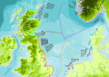
This layer is not available in the North Sea Edition.
2 KB (327 words) - 14:33, 3 April 2023
| header1 = Layer Info
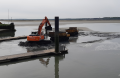
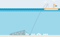
Dumping Areas is a static data layer. They are polygons, i.e., geometric shapes that you can draw in, edit or re
2 KB (238 words) - 14:29, 6 April 2021
| label2 = Utilizing Layer | data2 = [[{{PARENTPAGES}}|{{PAGENAME:{{PARENTPAGES}}}}]]
439 bytes (49 words) - 15:05, 16 June 2021
| label2 = Utilizing Layer | data2 = [[{{PARENTPAGES}}|{{PAGENAME:{{PARENTPAGES}}}}]]
427 bytes (48 words) - 11:40, 6 October 2021
| header1 = Layer Info
Here you can add information about how the layer is implemented or used in the MSP Challenge
2 KB (226 words) - 14:21, 26 August 2021
| label2 = Utilizing Layer | data2 = [[{{PARENTPAGES}}|{{PAGENAME:{{PARENTPAGES}}}}]]
427 bytes (48 words) - 11:37, 6 October 2021
| header1 = Layer Info
Here you can add information about how the layer is implemented or used in the MSP Challenge
2 KB (252 words) - 14:09, 19 July 2021
| header1 = Layer Info
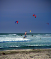
The Wind Surfing layer shows popular areas for wind surfing.
1 KB (202 words) - 07:07, 4 April 2023
| header1 = Layer Info
...f one single data layer. This is a month-by-month, computer generated data layer following calculations made by the ecosystem simulation (EwE).
3 KB (359 words) - 09:41, 1 April 2021
| label2 = Utilizing Layer | data2 = [[{{PARENTPAGES}}|{{PAGENAME:{{PARENTPAGES}}}}]]
440 bytes (49 words) - 15:05, 16 June 2021
| header1 = Layer Info
Here you can add information about how the layer is implemented or used in the MSP Challenge
1 KB (185 words) - 11:40, 6 October 2021
| label2 = Utilizing Layer | data2 = [[{{PARENTPAGES}}|{{PAGENAME:{{PARENTPAGES}}}}]]
429 bytes (49 words) - 15:37, 10 June 2021
| label2 = Utilizing Layer | data2 = [[{{PARENTPAGES}}|{{PAGENAME:{{PARENTPAGES}}}}]]
443 bytes (49 words) - 11:37, 6 October 2021
| header1 = Layer Info
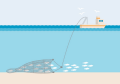
...here fishing with [[Drift and Fixed Nets Catch|nets]] is not allowed. This layer is calculated by the simulations in the MSP Challenge.
2 KB (285 words) - 12:47, 4 April 2023
| header1 = Layer Info
| header10 = Layer
798 bytes (92 words) - 14:29, 6 April 2021
| header1 = Layer Info
| header10 = Layer
805 bytes (96 words) - 20:37, 17 November 2020
| label2 = Utilizing Layer | data2 = [[{{PARENTPAGES}}|{{PAGENAME:{{PARENTPAGES}}}}]]
427 bytes (48 words) - 15:06, 16 June 2021
| label2 = Utilizing Layer | data2 = [[{{PARENTPAGES}}|{{PAGENAME:{{PARENTPAGES}}}}]]
425 bytes (48 words) - 11:40, 6 October 2021
| label2 = Utilizing Layer | data2 = [[{{PARENTPAGES}}|{{PAGENAME:{{PARENTPAGES}}}}]]
427 bytes (48 words) - 15:37, 10 June 2021
| header1 = Layer Info
Here you can add information about how the layer is implemented or used in the MSP Challenge
1 KB (179 words) - 11:38, 6 October 2021
| header1 = Layer Info
| header10 = Layer
798 bytes (92 words) - 14:29, 6 April 2021
| header1 = Layer Info
| header10 = Layer
796 bytes (95 words) - 20:38, 17 November 2020
| label2 = Utilizing Layer | data2 = [[{{PARENTPAGES}}|{{PAGENAME:{{PARENTPAGES}}}}]]
444 bytes (49 words) - 15:06, 16 June 2021
| header1 = Layer Info
| header10 = Utilizing Layer
10 KB (1,652 words) - 15:02, 14 November 2023
| label2 = Utilizing Layer | data2 = [[{{PARENTPAGES}}|{{PAGENAME:{{PARENTPAGES}}}}]]
438 bytes (50 words) - 15:38, 10 June 2021
| label2 = Utilizing Layer | data2 = [[{{PARENTPAGES}}|{{PAGENAME:{{PARENTPAGES}}}}]]
424 bytes (48 words) - 11:38, 6 October 2021
| header1 = Layer Info
607 bytes (69 words) - 13:40, 6 April 2021
| header1 = Layer Info
This is a month-by-month, computer generated data layer following the identification of an [[(NS)Protected Areas|MPA]] of the type
2 KB (219 words) - 20:09, 17 November 2020
| label2 = Utilizing Layer | data2 = [[{{PARENTPAGES}}|{{PAGENAME:{{PARENTPAGES}}}}]]
442 bytes (50 words) - 15:07, 16 June 2021
| header1 = Layer Info
...trial and Pelagic Trawl Catch is a month-by-month, computer generated data layer following this fleet's fishing efforts calculated by the ecosystem simulati
3 KB (479 words) - 13:24, 3 April 2023
| header1 = Layer Info
Here you can add information about how the layer is implemented or used in the MSP Challenge
2 KB (218 words) - 15:03, 16 June 2021
| label2 = Utilizing Layer | data2 = [[{{PARENTPAGES}}|{{PAGENAME:{{PARENTPAGES}}}}]]
434 bytes (49 words) - 11:38, 6 October 2021
| header1 = Layer Info
The sediments layer protraits the type of sea floor you can find in the Baltic Sea area.
2 KB (319 words) - 15:34, 11 November 2021
| header1 = Layer Info
| header10 = Layer
613 bytes (69 words) - 20:37, 17 November 2020
| label2 = Utilizing Layer | data2 = [[{{PARENTPAGES}}|{{PAGENAME:{{PARENTPAGES}}}}]]
434 bytes (49 words) - 15:07, 16 June 2021
| label2 = Utilizing Layer | data2 = [[{{PARENTPAGES}}|{{PAGENAME:{{PARENTPAGES}}}}]]
443 bytes (51 words) - 15:04, 16 June 2021
| label2 = Utilizing Layer | data2 = [[{{PARENTPAGES}}|{{PAGENAME:{{PARENTPAGES}}}}]]
434 bytes (49 words) - 11:39, 6 October 2021
| label2 = Utilizing Layer | data2 = [[{{PARENTPAGES}}|{{PAGENAME:{{PARENTPAGES}}}}]]
425 bytes (48 words) - 15:36, 10 June 2021
| header1 = Layer Info
Here you can add information about how the layer is implemented or used in the MSP Challenge
1 KB (194 words) - 15:08, 16 June 2021
| label2 = Utilizing Layer | data2 = [[{{PARENTPAGES}}|{{PAGENAME:{{PARENTPAGES}}}}]]
425 bytes (48 words) - 15:35, 10 June 2021
| header1 = Layer Info
998 bytes (129 words) - 20:08, 17 November 2020
| label2 = Utilizing Layer | data2 = [[{{PARENTPAGES}}|{{PAGENAME:{{PARENTPAGES}}}}]]
427 bytes (48 words) - 15:04, 16 June 2021
| label2 = Utilizing Layer | data2 = [[{{PARENTPAGES}}|{{PAGENAME:{{PARENTPAGES}}}}]]
428 bytes (48 words) - 11:39, 6 October 2021
| header1 = Layer Info
Here you can add information about how the layer is implemented or used in the MSP Challenge
1 KB (190 words) - 15:04, 16 June 2021
| label2 = Utilizing Layer | data2 = [[{{PARENTPAGES}}|{{PAGENAME:{{PARENTPAGES}}}}]]
427 bytes (48 words) - 11:39, 6 October 2021
| label2 = Utilizing Layer | data2 = [[{{PARENTPAGES}}|{{PAGENAME:{{PARENTPAGES}}}}]]
425 bytes (47 words) - 15:36, 10 June 2021
| header1 = Layer Info
Here you can add information about how the layer is implemented or used in the MSP Challenge
1 KB (174 words) - 11:37, 6 October 2021
| header1 = Layer Info
Here you can add information about how the layer is implemented or used in the MSP Challenge
746 bytes (88 words) - 13:18, 14 March 2022
| header1 = Layer Info
Telecom Cables is a static data layer. They are point-by-point lines that you can draw in, edit or remove when ma
7 KB (1,005 words) - 15:14, 3 April 2023
| header1 = Layer Info
...trial and Pelagic Trawl Catch is a month-by-month, computer generated data layer following this fleet's fishing efforts calculated by the ecosystem simulati
2 KB (298 words) - 09:41, 1 April 2021
| label2 = Utilizing Layer | data2 = [[{{PARENTPAGES}}|{{PAGENAME:{{PARENTPAGES}}}}]]
443 bytes (50 words) - 15:05, 16 June 2021
| header1 = Layer Info
Here you can add information about how the layer is implemented or used in the MSP Challenge
1 KB (182 words) - 11:40, 6 October 2021
| header1 = Layer Info
Here you can add information about how the layer is implemented or used in the MSP Challenge
2 KB (200 words) - 10:25, 20 July 2021
| label2 = Utilizing Layer | data2 = [[{{PARENTPAGES}}|{{PAGENAME:{{PARENTPAGES}}}}]]
425 bytes (48 words) - 11:37, 6 October 2021
| label2 = Utilizing Layer | data2 = [[{{PARENTPAGES}}|{{PAGENAME:{{PARENTPAGES}}}}]]
425 bytes (48 words) - 15:36, 10 June 2021
| header1 = Layer Info
This is a static layer for information only.
2 KB (250 words) - 12:16, 14 May 2024
| header1 = Layer Info
650 bytes (77 words) - 09:42, 1 April 2021
| header1 = Layer Info
Here you can add information about how the layer is implemented or used in the MSP Challenge
1 KB (158 words) - 15:05, 16 June 2021
| label2 = Utilizing Layer | data2 = [[{{PARENTPAGES}}|{{PAGENAME:{{PARENTPAGES}}}}]]
425 bytes (48 words) - 11:40, 6 October 2021
| header1 = Layer Info
Here you can add information about how the layer is implemented or used in the MSP Challenge
998 bytes (113 words) - 15:37, 10 June 2021
| label2 = Utilizing Layer | data2 = [[{{PARENTPAGES}}|{{PAGENAME:{{PARENTPAGES}}}}]]
430 bytes (48 words) - 11:37, 6 October 2021
| header1 = Layer Info
...seabed habitats is an informative layer, users might want to consult this layer as looking for areas that need protection regarding activities that may dam
2 KB (233 words) - 13:52, 4 April 2023
| header1 = Layer Info
| header10 = Layer
609 bytes (62 words) - 14:29, 6 April 2021
| header1 = Layer Info
| header10 = Layer
791 bytes (94 words) - 20:38, 17 November 2020
| label2 = Utilizing Layer | data2 = [[{{PARENTPAGES}}|{{PAGENAME:{{PARENTPAGES}}}}]]
433 bytes (49 words) - 15:06, 16 June 2021
| label2 = Utilizing Layer | data2 = [[{{PARENTPAGES}}|{{PAGENAME:{{PARENTPAGES}}}}]]
434 bytes (49 words) - 11:40, 6 October 2021
| label2 = Utilizing Layer | data2 = [[{{PARENTPAGES}}|{{PAGENAME:{{PARENTPAGES}}}}]]
432 bytes (49 words) - 15:38, 10 June 2021
| label2 = Utilizing Layer | data2 = [[{{PARENTPAGES}}|{{PAGENAME:{{PARENTPAGES}}}}]]
438 bytes (49 words) - 11:38, 6 October 2021
| header1 = Layer Info
| header10 = Layer
798 bytes (92 words) - 14:30, 6 April 2021
| header1 = Layer Info
Ferry Intensity is a month-by-month, computer generated data layer showing a 'heat map' of as yet limited ferries. The shipping simulation con
2 KB (351 words) - 20:09, 17 November 2020
| header1 = Layer Info
Here you can add information about how the layer is implemented or used in the MSP Challenge
1 KB (178 words) - 15:06, 16 June 2021
| header1 = Layer Info
This layer is for information purposes only; it can help deciding which areas to give
3 KB (359 words) - 12:45, 3 April 2023
| label2 = Utilizing Layer | data2 = [[{{PARENTPAGES}}|{{PAGENAME:{{PARENTPAGES}}}}]]
438 bytes (50 words) - 15:38, 10 June 2021
| label2 = Utilizing Layer | data2 = [[{{PARENTPAGES}}|{{PAGENAME:{{PARENTPAGES}}}}]]
461 bytes (52 words) - 11:38, 6 October 2021
| label2 = Utilizing Layer | data2 = [[{{PARENTPAGES}}|{{PAGENAME:{{PARENTPAGES}}}}]]
427 bytes (48 words) - 15:26, 10 June 2021
| header1 = Layer Info
Windfarm indifferent seabirds is a month-by-month, computer generated data layer following calculations made by the ecosystem simulation (EwE).
1 KB (135 words) - 20:09, 17 November 2020
| label2 = Utilizing Layer | data2 = [[{{PARENTPAGES}}|{{PAGENAME:{{PARENTPAGES}}}}]]
428 bytes (50 words) - 15:07, 16 June 2021
| header1 = Layer Info
...EMODnet data layer used was the "Dredge Spoil Dumping", the polygon-based layer was used.
6 KB (867 words) - 12:25, 2 April 2024
| header1 = Layer Info
Here you can add information about how the layer is implemented or used in the MSP Challenge
1 KB (185 words) - 15:04, 16 June 2021
| label2 = Utilizing Layer | data2 = [[{{PARENTPAGES}}|{{PAGENAME:{{PARENTPAGES}}}}]]
431 bytes (49 words) - 11:39, 6 October 2021
| label2 = Utilizing Layer | data2 = [[{{PARENTPAGES}}|{{PAGENAME:{{PARENTPAGES}}}}]]
427 bytes (48 words) - 15:34, 10 June 2021
| header1 = Layer Info
| header10 = Utilizing Layer
3 KB (485 words) - 20:37, 17 November 2020
| header1 = Layer Info
Here you can add information about how the layer is implemented or used in the MSP Challenge
1 KB (167 words) - 15:04, 16 June 2021
| label2 = Utilizing Layer | data2 = [[{{PARENTPAGES}}|{{PAGENAME:{{PARENTPAGES}}}}]]
428 bytes (48 words) - 11:39, 6 October 2021
| label2 = Utilizing Layer | data2 = [[{{PARENTPAGES}}|{{PAGENAME:{{PARENTPAGES}}}}]]
443 bytes (51 words) - 15:36, 10 June 2021
| header1 = Layer Info
Here you can add information about how the layer is implemented or used in the MSP Challenge
1 KB (156 words) - 11:36, 6 October 2021
| header1 = Layer Info
Here you can add information about how the layer is implemented or used in the MSP Challenge
2 KB (302 words) - 09:42, 20 July 2021
| header1 = Layer Info
1 KB (125 words) - 20:08, 17 November 2020
| header1 = Layer Info
Artificial substrate is a month-by-month computer generated data layer, based on any of the following human activities:
1 KB (178 words) - 09:40, 1 April 2021
| header1 = Layer Info
Here you can add information about how the layer is implemented or used in the MSP Challenge
1 KB (155 words) - 15:05, 16 June 2021
| header1 = Layer Info
Here you can add information about how the layer is implemented or used in the MSP Challenge
1 KB (184 words) - 11:39, 6 October 2021
| label2 = Utilizing Layer | data2 = [[{{PARENTPAGES}}|{{PAGENAME:{{PARENTPAGES}}}}]]
429 bytes (49 words) - 15:36, 10 June 2021
| label2 = Utilizing Layer | data2 = [[{{PARENTPAGES}}|{{PAGENAME:{{PARENTPAGES}}}}]]
427 bytes (48 words) - 11:37, 6 October 2021
| label2 = Utilizing Layer | data2 = [[{{PARENTPAGES}}|{{PAGENAME:{{PARENTPAGES}}}}]]
425 bytes (48 words) - 15:35, 10 June 2021
| header1 = Layer Info
This is a static layer and does not contribute to the pressures on the ecossystem.
3 KB (345 words) - 13:48, 16 May 2024
| header1 = Layer Info
Passenger Intensity is a month-by-month, computer generated data layer showing a 'heat map' of main passenger cruise line traffic. The shipping si
2 KB (325 words) - 09:41, 1 April 2021
| label2 = Utilizing Layer | data2 = [[{{PARENTPAGES}}|{{PAGENAME:{{PARENTPAGES}}}}]]
441 bytes (49 words) - 15:05, 16 June 2021
| label2 = Utilizing Layer | data2 = [[{{PARENTPAGES}}|{{PAGENAME:{{PARENTPAGES}}}}]]
425 bytes (48 words) - 11:40, 6 October 2021
| label2 = Utilizing Layer | data2 = [[{{PARENTPAGES}}|{{PAGENAME:{{PARENTPAGES}}}}]]
436 bytes (49 words) - 15:37, 10 June 2021
| label2 = Utilizing Layer | data2 = [[{{PARENTPAGES}}|{{PAGENAME:{{PARENTPAGES}}}}]]
430 bytes (49 words) - 11:37, 6 October 2021
| label2 = Utilizing Layer | data2 = [[{{PARENTPAGES}}|{{PAGENAME:{{PARENTPAGES}}}}]]
434 bytes (49 words) - 15:36, 10 June 2021
| header1 = Layer Info
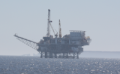
Oil and gas safety zones is a static layer for information purposes only.
2 KB (210 words) - 12:42, 4 April 2023
| header1 = Layer Info
2 KB (312 words) - 14:29, 6 April 2021
| title = NAME OF THE LAYER/TYPE
| header1 = Layer Info
859 bytes (117 words) - 13:23, 17 November 2020
| label2 = Utilizing Layer | data2 = [[{{PARENTPAGES}}|{{PAGENAME:{{PARENTPAGES}}}}]]
436 bytes (49 words) - 15:06, 16 June 2021
| label2 = Utilizing Layer | data2 = [[{{PARENTPAGES}}|{{PAGENAME:{{PARENTPAGES}}}}]]
434 bytes (49 words) - 11:40, 6 October 2021
| label2 = Utilizing Layer | data2 = [[{{PARENTPAGES}}|{{PAGENAME:{{PARENTPAGES}}}}]]
430 bytes (49 words) - 15:37, 10 June 2021
| label2 = Utilizing Layer | data2 = [[{{PARENTPAGES}}|{{PAGENAME:{{PARENTPAGES}}}}]]
430 bytes (48 words) - 11:38, 6 October 2021
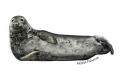
| header1 = Layer Info
Seal is a month-by-month, computer generated data layer following calculations made by the ecosystem simulation (EwE). For more inf
5 KB (732 words) - 11:51, 11 October 2023
| header1 = Layer Info
| header10 = Layer
798 bytes (92 words) - 14:29, 6 April 2021
| header1 = Layer Info
Eutrophication Status is a static data layer.
1 KB (184 words) - 20:09, 17 November 2020
| label2 = Utilizing Layer | data2 = [[{{PARENTPAGES}}|{{PAGENAME:{{PARENTPAGES}}}}]]
443 bytes (49 words) - 15:06, 16 June 2021
| header1 = Layer Info
| header10 = Layer
655 bytes (74 words) - 12:47, 11 January 2022
| label2 = Utilizing Layer | data2 = [[{{PARENTPAGES}}|{{PAGENAME:{{PARENTPAGES}}}}]]
437 bytes (50 words) - 15:38, 10 June 2021
| label2 = Utilizing Layer | data2 = [[{{PARENTPAGES}}|{{PAGENAME:{{PARENTPAGES}}}}]]
425 bytes (47 words) - 11:38, 6 October 2021
| header1 = Layer Info
4 KB (552 words) - 13:40, 6 April 2021
| header1 = Layer Info
Artificial substrate is a month-by-month computer generated data layer, based on any of the following human activities:
1 KB (182 words) - 20:08, 17 November 2020
| label2 = Utilizing Layer | data2 = [[{{PARENTPAGES}}|{{PAGENAME:{{PARENTPAGES}}}}]]
426 bytes (48 words) - 15:07, 16 June 2021
| header1 = Layer Info
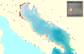
...MSP Challenge editions (only the Adriatic Sea at the time of writing). The layer is just a useful indication for the red country planners, the plans are app
1 KB (206 words) - 12:24, 3 April 2023
| header1 = Layer Info
Here you can add information about how the layer is implemented or used in the MSP Challenge
1 KB (163 words) - 15:03, 16 June 2021
| label2 = Utilizing Layer | data2 = [[{{PARENTPAGES}}|{{PAGENAME:{{PARENTPAGES}}}}]]
524 bytes (60 words) - 11:38, 6 October 2021
| label2 = Utilizing Layer | data2 = [[{{PARENTPAGES}}|{{PAGENAME:{{PARENTPAGES}}}}]]
434 bytes (50 words) - 15:34, 10 June 2021
| header1 = Layer Info
Electricity Cables is a static data layer. They are point-by-point lines that you can draw in, edit or remove when ma
2 KB (221 words) - 20:09, 17 November 2020
| label2 = Utilizing Layer | data2 = [[{{PARENTPAGES}}|{{PAGENAME:{{PARENTPAGES}}}}]]
428 bytes (50 words) - 15:07, 16 June 2021
| label2 = Utilizing Layer | data2 = [[{{PARENTPAGES}}|{{PAGENAME:{{PARENTPAGES}}}}]]
424 bytes (48 words) - 15:04, 16 June 2021
| label2 = Utilizing Layer | data2 = [[{{PARENTPAGES}}|{{PAGENAME:{{PARENTPAGES}}}}]]
427 bytes (48 words) - 11:39, 6 October 2021
| label2 = Utilizing Layer | data2 = [[{{PARENTPAGES}}|{{PAGENAME:{{PARENTPAGES}}}}]]
425 bytes (48 words) - 15:07, 16 June 2021
| header1 = Layer Info
This layer is just a background layer.
2 KB (293 words) - 14:53, 26 August 2021
| header1 = Layer Info
| header10 = Layer
849 bytes (107 words) - 20:38, 17 November 2020
| label2 = Utilizing Layer | data2 = [[{{PARENTPAGES}}|{{PAGENAME:{{PARENTPAGES}}}}]]
425 bytes (48 words) - 15:04, 16 June 2021
| label2 = Utilizing Layer | data2 = [[{{PARENTPAGES}}|{{PAGENAME:{{PARENTPAGES}}}}]]
427 bytes (48 words) - 11:39, 6 October 2021
| label2 = Utilizing Layer | data2 = [[{{PARENTPAGES}}|{{PAGENAME:{{PARENTPAGES}}}}]]
426 bytes (48 words) - 15:36, 10 June 2021
| label2 = Utilizing Layer | data2 = [[{{PARENTPAGES}}|{{PAGENAME:{{PARENTPAGES}}}}]]
428 bytes (48 words) - 11:36, 6 October 2021
| label2 = Utilizing Layer | data2 = [[{{PARENTPAGES}}|{{PAGENAME:{{PARENTPAGES}}}}]]
459 bytes (52 words) - 15:35, 10 June 2021
| label2 = Utilizing Layer | data2 = [[{{PARENTPAGES}}|{{PAGENAME:{{PARENTPAGES}}}}]]
425 bytes (47 words) - 15:36, 10 June 2021
| label2 = Utilizing Layer | data2 = [[{{PARENTPAGES}}|{{PAGENAME:{{PARENTPAGES}}}}]]
425 bytes (48 words) - 11:36, 6 October 2021
| label2 = Utilizing Layer | data2 = [[{{PARENTPAGES}}|{{PAGENAME:{{PARENTPAGES}}}}]]
436 bytes (50 words) - 15:35, 10 June 2021
| header1 = Layer Info
The layer wrecks gives a general overview of archaeological remains in a sea region.
3 KB (492 words) - 14:31, 3 April 2023
| header1 = Layer Info
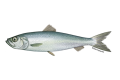
Drift and Fixed Nets Catch is a month-by-month, computer generated data layer following this fleet's fishing efforts calculated by the ecosystem simulati
2 KB (261 words) - 09:40, 1 April 2021
| label2 = Utilizing Layer | data2 = [[{{PARENTPAGES}}|{{PAGENAME:{{PARENTPAGES}}}}]]
441 bytes (49 words) - 15:05, 16 June 2021
| label2 = Utilizing Layer | data2 = [[{{PARENTPAGES}}|{{PAGENAME:{{PARENTPAGES}}}}]]
425 bytes (48 words) - 11:40, 6 October 2021
| label2 = Utilizing Layer | data2 = [[{{PARENTPAGES}}|{{PAGENAME:{{PARENTPAGES}}}}]]
434 bytes (49 words) - 15:37, 10 June 2021
| label2 = Utilizing Layer | data2 = [[{{PARENTPAGES}}|{{PAGENAME:{{PARENTPAGES}}}}]]
425 bytes (48 words) - 11:37, 6 October 2021
| label2 = Utilizing Layer | data2 = [[{{PARENTPAGES}}|{{PAGENAME:{{PARENTPAGES}}}}]]
434 bytes (49 words) - 15:35, 10 June 2021
| header1 = Layer Info
The Walking data layer represents nice areas to walk in.
1 KB (198 words) - 07:07, 4 April 2023
| header1 = Layer Info
2 KB (272 words) - 09:41, 1 April 2021
| label2 = Utilizing Layer | data2 = [[{{PARENTPAGES}}|{{PAGENAME:{{PARENTPAGES}}}}]]
432 bytes (48 words) - 15:05, 16 June 2021
| label2 = Utilizing Layer | data2 = [[{{PARENTPAGES}}|{{PAGENAME:{{PARENTPAGES}}}}]]
434 bytes (49 words) - 11:40, 6 October 2021
| label2 = Utilizing Layer | data2 = [[{{PARENTPAGES}}|{{PAGENAME:{{PARENTPAGES}}}}]]
424 bytes (48 words) - 15:37, 10 June 2021
| label2 = Utilizing Layer | data2 = [[{{PARENTPAGES}}|{{PAGENAME:{{PARENTPAGES}}}}]]
433 bytes (48 words) - 11:37, 6 October 2021
| header1 = Layer Info
Unesco Sites is a static layer for information purposes only.
2 KB (326 words) - 12:46, 4 April 2023
| header1 = Layer Info
| header10 = Layer
798 bytes (92 words) - 14:29, 6 April 2021
| header1 = Layer Info
2 KB (254 words) - 12:53, 27 June 2022
| label2 = Utilizing Layer | data2 = [[{{PARENTPAGES}}|{{PAGENAME:{{PARENTPAGES}}}}]]
425 bytes (48 words) - 15:06, 16 June 2021
| label2 = Utilizing Layer | data2 = [[{{PARENTPAGES}}|{{PAGENAME:{{PARENTPAGES}}}}]]
431 bytes (49 words) - 11:40, 6 October 2021
| label2 = Utilizing Layer | data2 = [[{{PARENTPAGES}}|{{PAGENAME:{{PARENTPAGES}}}}]]
425 bytes (48 words) - 15:37, 10 June 2021
| label2 = Utilizing Layer | data2 = [[{{PARENTPAGES}}|{{PAGENAME:{{PARENTPAGES}}}}]]
428 bytes (48 words) - 11:38, 6 October 2021
| header1 = Layer Info
| header10 = Layer
798 bytes (92 words) - 14:29, 6 April 2021
| header1 = Layer Info
| header10 = Layer
799 bytes (95 words) - 20:38, 17 November 2020
| label2 = Utilizing Layer | data2 = [[{{PARENTPAGES}}|{{PAGENAME:{{PARENTPAGES}}}}]]
447 bytes (49 words) - 15:06, 16 June 2021
| header1 = Layer Info
| header10 = Utilizing Layer
10 KB (1,616 words) - 10:40, 19 March 2024
| header1 = Layer Info
Here you can add information about how the layer is implemented or used in the MSP Challenge
1 KB (123 words) - 15:38, 10 June 2021
| label2 = Utilizing Layer | data2 = [[{{PARENTPAGES}}|{{PAGENAME:{{PARENTPAGES}}}}]]
427 bytes (48 words) - 11:38, 6 October 2021
| header1 = Layer Info
716 bytes (76 words) - 13:40, 6 April 2021
| header1 = Layer Info
Benthic invertebrates is a month-by-month, computer generated data layer following calculations made by the ecosystem simulation (EwE).
1 KB (182 words) - 20:08, 17 November 2020
| header1 = Layer Info
Here you can add information about how the layer is implemented or used in the MSP Challenge
1 KB (196 words) - 15:07, 16 June 2021
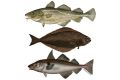
| image = [[File:Layer Bottom Trawl Catch.png|200px]]
| header1 = Layer Info
4 KB (546 words) - 13:29, 3 April 2023
| label2 = Utilizing Layer | data2 = [[{{PARENTPAGES}}|{{PAGENAME:{{PARENTPAGES}}}}]]
429 bytes (49 words) - 15:03, 16 June 2021
| label2 = Utilizing Layer | data2 = [[{{PARENTPAGES}}|{{PAGENAME:{{PARENTPAGES}}}}]]
424 bytes (48 words) - 11:38, 6 October 2021
| label2 = Utilizing Layer | data2 = [[{{PARENTPAGES}}|{{PAGENAME:{{PARENTPAGES}}}}]]
432 bytes (49 words) - 15:34, 10 June 2021
| header1 = Layer Info
| header10 = Layer
807 bytes (103 words) - 20:37, 17 November 2020
| label2 = Utilizing Layer | data2 = [[{{PARENTPAGES}}|{{PAGENAME:{{PARENTPAGES}}}}]]
444 bytes (51 words) - 15:04, 16 June 2021
| label2 = Utilizing Layer | data2 = [[{{PARENTPAGES}}|{{PAGENAME:{{PARENTPAGES}}}}]]
424 bytes (48 words) - 11:39, 6 October 2021
| label2 = Utilizing Layer | data2 = [[{{PARENTPAGES}}|{{PAGENAME:{{PARENTPAGES}}}}]]
431 bytes (49 words) - 15:36, 10 June 2021
| label2 = Utilizing Layer | data2 = [[{{PARENTPAGES}}|{{PAGENAME:{{PARENTPAGES}}}}]]
434 bytes (49 words) - 15:08, 16 June 2021
| label2 = Utilizing Layer | data2 = [[{{PARENTPAGES}}|{{PAGENAME:{{PARENTPAGES}}}}]]
433 bytes (49 words) - 15:35, 10 June 2021
| header1 = Layer Info
589 bytes (67 words) - 20:08, 17 November 2020
| header1 = Layer Info
Here you can add information about how the layer is implemented or used in the MSP Challenge
1 KB (179 words) - 15:04, 16 June 2021
| header1 = Layer Info
Here you can add information about how the layer is implemented or used in the MSP Challenge
1 KB (182 words) - 11:39, 6 October 2021
| label2 = Utilizing Layer | data2 = [[{{PARENTPAGES}}|{{PAGENAME:{{PARENTPAGES}}}}]]
502 bytes (57 words) - 15:05, 16 June 2021
| label2 = Utilizing Layer | data2 = [[{{PARENTPAGES}}|{{PAGENAME:{{PARENTPAGES}}}}]]
425 bytes (48 words) - 11:39, 6 October 2021
| label2 = Utilizing Layer | data2 = [[{{PARENTPAGES}}|{{PAGENAME:{{PARENTPAGES}}}}]]
425 bytes (47 words) - 15:36, 10 June 2021
| label2 = Utilizing Layer | data2 = [[{{PARENTPAGES}}|{{PAGENAME:{{PARENTPAGES}}}}]]
425 bytes (48 words) - 11:37, 6 October 2021
| header1 = Layer Info
Here you can add information about how the layer is implemented or used in the MSP Challenge
760 bytes (89 words) - 15:35, 10 June 2021
| header1 = Layer Info
Unused Cables is a static data layer. They are point-by-point lines that you can draw in, edit or remove when ma
2 KB (282 words) - 15:21, 3 April 2023
| header1 = Layer Info
The large fish indicator a month-by-month, computer generated data layer following calculations made by the ecosystem simulation (EwE).
2 KB (218 words) - 09:26, 3 April 2022
| header1 = Layer Info
Here you can add information about how the layer is implemented or used in the MSP Challenge
2 KB (196 words) - 15:05, 16 June 2021
| label2 = Utilizing Layer | data2 = [[{{PARENTPAGES}}|{{PAGENAME:{{PARENTPAGES}}}}]]
434 bytes (49 words) - 11:40, 6 October 2021
| header1 = Layer Info
Here you can add information about how the layer is implemented or used in the MSP Challenge
2 KB (209 words) - 15:30, 16 March 2022
| label2 = Utilizing Layer | data2 = [[{{PARENTPAGES}}|{{PAGENAME:{{PARENTPAGES}}}}]]
430 bytes (49 words) - 11:37, 6 October 2021
| label2 = Utilizing Layer | data2 = [[{{PARENTPAGES}}|{{PAGENAME:{{PARENTPAGES}}}}]]
431 bytes (49 words) - 15:36, 10 June 2021
| header1 = Layer Info
This layer is for information purposes only; it can help deciding which areas to give
4 KB (522 words) - 15:11, 27 March 2024
| header1 = Layer Info
Unused Cables is a static data layer. They are point-by-point lines that you can draw in, edit or remove when ma
1 KB (166 words) - 09:42, 1 April 2021
| header1 = Layer Info
Here you can add information about how the layer is implemented or used in the MSP Challenge
2 KB (196 words) - 15:05, 16 June 2021
| label2 = Utilizing Layer | data2 = [[{{PARENTPAGES}}|{{PAGENAME:{{PARENTPAGES}}}}]]
431 bytes (49 words) - 11:40, 6 October 2021
| label2 = Utilizing Layer | data2 = [[{{PARENTPAGES}}|{{PAGENAME:{{PARENTPAGES}}}}]]
429 bytes (49 words) - 15:37, 10 June 2021
| label2 = Utilizing Layer | data2 = [[{{PARENTPAGES}}|{{PAGENAME:{{PARENTPAGES}}}}]]
427 bytes (48 words) - 11:37, 6 October 2021
| header1 = Layer Info
...he '''Sandeel''' layer. For more information about the interaction of this layer within the MSP Challenge go to the [[Sandeel|Sandeel information page]].
5 KB (728 words) - 13:15, 11 October 2023
| header1 = Layer Info
| header10 = Layer
806 bytes (99 words) - 14:29, 6 April 2021
| header1 = Layer Info
| header10 = Layer
798 bytes (95 words) - 20:38, 17 November 2020
| label2 = Utilizing Layer | data2 = [[{{PARENTPAGES}}|{{PAGENAME:{{PARENTPAGES}}}}]]
438 bytes (50 words) - 15:06, 16 June 2021
| label2 = Utilizing Layer | data2 = [[{{PARENTPAGES}}|{{PAGENAME:{{PARENTPAGES}}}}]]
424 bytes (48 words) - 11:40, 6 October 2021
| label2 = Utilizing Layer | data2 = [[{{PARENTPAGES}}|{{PAGENAME:{{PARENTPAGES}}}}]]
435 bytes (49 words) - 15:38, 10 June 2021
| label2 = Utilizing Layer | data2 = [[{{PARENTPAGES}}|{{PAGENAME:{{PARENTPAGES}}}}]]
438 bytes (49 words) - 11:38, 6 October 2021
| header1 = Layer Info
| header10 = Layer
696 bytes (81 words) - 14:30, 6 April 2021
| header1 = Layer Info
| header10 = Layer
798 bytes (96 words) - 20:37, 17 November 2020
| label2 = Utilizing Layer | data2 = [[{{PARENTPAGES}}|{{PAGENAME:{{PARENTPAGES}}}}]]
428 bytes (49 words) - 15:06, 16 June 2021
| header1 = Layer Info
This layer is for information purposes only; it can help deciding which areas to give
3 KB (422 words) - 12:48, 3 April 2023
| label2 = Utilizing Layer | data2 = [[{{PARENTPAGES}}|{{PAGENAME:{{PARENTPAGES}}}}]]
437 bytes (50 words) - 15:38, 10 June 2021
| label2 = Utilizing Layer | data2 = [[{{PARENTPAGES}}|{{PAGENAME:{{PARENTPAGES}}}}]]
440 bytes (50 words) - 11:38, 6 October 2021
| label2 = Utilizing Layer | data2 = [[{{PARENTPAGES}}|{{PAGENAME:{{PARENTPAGES}}}}]]
426 bytes (48 words) - 15:34, 10 June 2021
| header1 = Layer Info
...f one single data layer. This is a month-by-month, computer generated data layer following calculations made by the ecosystem simulation (EwE).
3 KB (362 words) - 20:09, 17 November 2020
| header1 = Layer Info
Here you can add information about how the layer is implemented or used in the MSP Challenge
1 KB (198 words) - 15:07, 16 June 2021
| header1 = Layer Info
Joint layer created on 2018/03.
5 KB (636 words) - 11:42, 15 May 2023
| label2 = Utilizing Layer | data2 = [[{{PARENTPAGES}}|{{PAGENAME:{{PARENTPAGES}}}}]]
424 bytes (48 words) - 15:04, 16 June 2021
| label2 = Utilizing Layer | data2 = [[{{PARENTPAGES}}|{{PAGENAME:{{PARENTPAGES}}}}]]
428 bytes (48 words) - 11:39, 6 October 2021
| label2 = Utilizing Layer | data2 = [[{{PARENTPAGES}}|{{PAGENAME:{{PARENTPAGES}}}}]]
425 bytes (48 words) - 15:34, 10 June 2021
| header1 = Layer Info
| header10 = Layer
670 bytes (83 words) - 20:38, 17 November 2020
| label2 = Utilizing Layer | data2 = [[{{PARENTPAGES}}|{{PAGENAME:{{PARENTPAGES}}}}]]
432 bytes (48 words) - 15:04, 16 June 2021
| header1 = Layer Info
Here you can add information about how the layer is implemented or used in the MSP Challenge
1 KB (184 words) - 11:39, 6 October 2021
| label2 = Utilizing Layer | data2 = [[{{PARENTPAGES}}|{{PAGENAME:{{PARENTPAGES}}}}]]
444 bytes (51 words) - 15:36, 10 June 2021
| header1 = Layer Info
Here you can add information about how the layer is implemented or used in the MSP Challenge
1 KB (160 words) - 11:36, 6 October 2021
| label2 = Utilizing Layer | data2 = [[{{PARENTPAGES}}|{{PAGENAME:{{PARENTPAGES}}}}]]
428 bytes (48 words) - 15:35, 10 June 2021
| header1 = Layer Info
690 bytes (72 words) - 20:08, 17 November 2020
| header1 = Layer Info
Bathymetry is a static data layer providing general indications of water depth in a particular area.
2 KB (196 words) - 10:49, 8 November 2021
| header1 = Layer Info
Here you can add information about how the layer is implemented or used in the MSP Challenge
2 KB (195 words) - 15:05, 16 June 2021
| label2 = Utilizing Layer | data2 = [[{{PARENTPAGES}}|{{PAGENAME:{{PARENTPAGES}}}}]]
434 bytes (49 words) - 11:39, 6 October 2021
| label2 = Utilizing Layer | data2 = [[{{PARENTPAGES}}|{{PAGENAME:{{PARENTPAGES}}}}]]
424 bytes (48 words) - 15:36, 10 June 2021
| label2 = Utilizing Layer | data2 = [[{{PARENTPAGES}}|{{PAGENAME:{{PARENTPAGES}}}}]]
425 bytes (48 words) - 11:37, 6 October 2021
| label2 = Utilizing Layer | data2 = [[{{PARENTPAGES}}|{{PAGENAME:{{PARENTPAGES}}}}]]
431 bytes (49 words) - 15:35, 10 June 2021
| header1 = Layer Info
Bathing waters is a static layer. This adds no pressure on the ecosystem.
3 KB (462 words) - 13:57, 16 May 2024
| header1 = Layer Info
'''IN THIS TAB MAIN INFO ABOUT THE LAYER IS PLACED'''
801 bytes (97 words) - 09:41, 1 April 2021
| label2 = Utilizing Layer | data2 = [[{{PARENTPAGES}}|{{PAGENAME:{{PARENTPAGES}}}}]]
442 bytes (49 words) - 15:05, 16 June 2021
| label2 = Utilizing Layer | data2 = [[{{PARENTPAGES}}|{{PAGENAME:{{PARENTPAGES}}}}]]
431 bytes (49 words) - 11:40, 6 October 2021
| label2 = Utilizing Layer | data2 = [[{{PARENTPAGES}}|{{PAGENAME:{{PARENTPAGES}}}}]]
439 bytes (49 words) - 15:37, 10 June 2021
| header1 = Layer Info
Here you can add information about how the layer is implemented or used in the MSP Challenge
1 KB (183 words) - 11:37, 6 October 2021
| label2 = Utilizing Layer | data2 = [[{{PARENTPAGES}}|{{PAGENAME:{{PARENTPAGES}}}}]]
424 bytes (48 words) - 15:36, 10 June 2021
| header1 = Layer Info
The layer was reprojected to Lambert Azimuthal Equal Area (EPSG:3035). The geometries
9 KB (1,266 words) - 13:32, 4 April 2023
| header1 = Layer Info
| header10 = Layer
798 bytes (92 words) - 14:29, 6 April 2021
| header1 = Layer Info
Cities is a static data layer. Obviously not all cities are included; only the largest, major cities are
907 bytes (109 words) - 12:27, 21 March 2022
| label2 = Utilizing Layer | data2 = [[{{PARENTPAGES}}|{{PAGENAME:{{PARENTPAGES}}}}]]
443 bytes (51 words) - 15:06, 16 June 2021
| label2 = Utilizing Layer | data2 = [[{{PARENTPAGES}}|{{PAGENAME:{{PARENTPAGES}}}}]]
424 bytes (48 words) - 11:40, 6 October 2021
| header1 = Layer Info
Here you can add information about how the layer is implemented or used in the MSP Challenge
1,013 bytes (115 words) - 15:37, 10 June 2021
| label2 = Utilizing Layer | data2 = [[{{PARENTPAGES}}|{{PAGENAME:{{PARENTPAGES}}}}]]
430 bytes (48 words) - 11:38, 6 October 2021
| header1 = Layer Info
Not applicable. This layer is not available in the MSP Challenge North Sea Edition.
2 KB (328 words) - 15:49, 10 October 2023
| header1 = Layer Info
| header10 = Layer
798 bytes (92 words) - 14:29, 6 April 2021
| header1 = Layer Info
Sediments is a static data layer, providing useful information for planning different human activities, e.g.
2 KB (235 words) - 20:09, 17 November 2020
| label2 = Utilizing Layer | data2 = [[{{PARENTPAGES}}|{{PAGENAME:{{PARENTPAGES}}}}]]
443 bytes (49 words) - 15:06, 16 June 2021
| header1 = Layer Info
| header10 = Layer
500 bytes (56 words) - 12:44, 11 January 2022
| label2 = Utilizing Layer | data2 = [[{{PARENTPAGES}}|{{PAGENAME:{{PARENTPAGES}}}}]]
432 bytes (49 words) - 15:38, 10 June 2021
| header1 = Layer Info
Here you can add information about how the layer is implemented or used in the MSP Challenge
1 KB (179 words) - 11:38, 6 October 2021
| header1 = Layer Info
1 KB (150 words) - 13:40, 6 April 2021
| header1 = Layer Info
Bottom disturbance is a month-by-month, computer generated data layer, based on any of the following human activities:
1 KB (173 words) - 08:06, 17 March 2022
| header1 = Layer Info
Here you can add information about how the layer is implemented or used in the MSP Challenge
1 KB (164 words) - 15:07, 16 June 2021
| header1 = Layer Info
The Shannon Diversity Indicator a month-by-month, computer generated data layer following calculations made by the ecosystem simulation (EwE).
3 KB (429 words) - 09:27, 3 April 2022
| header1 = Layer Info
Here you can add information about how the layer is implemented or used in the MSP Challenge
1 KB (155 words) - 15:03, 16 June 2021
| label2 = Utilizing Layer | data2 = [[{{PARENTPAGES}}|{{PAGENAME:{{PARENTPAGES}}}}]]
480 bytes (56 words) - 11:38, 6 October 2021
| label2 = Utilizing Layer | data2 = [[{{PARENTPAGES}}|{{PAGENAME:{{PARENTPAGES}}}}]]
434 bytes (50 words) - 15:34, 10 June 2021
| header1 = Layer Info
'''IN THIS TAB MAIN INFO ABOUT THE LAYER IS PLACED'''
832 bytes (101 words) - 20:09, 17 November 2020
| label2 = Utilizing Layer | data2 = [[{{PARENTPAGES}}|{{PAGENAME:{{PARENTPAGES}}}}]]
428 bytes (50 words) - 15:07, 16 June 2021
| label2 = Utilizing Layer | data2 = [[{{PARENTPAGES}}|{{PAGENAME:{{PARENTPAGES}}}}]]
438 bytes (50 words) - 15:04, 16 June 2021
| label2 = Utilizing Layer | data2 = [[{{PARENTPAGES}}|{{PAGENAME:{{PARENTPAGES}}}}]]
425 bytes (48 words) - 11:39, 6 October 2021
| label2 = Utilizing Layer | data2 = [[{{PARENTPAGES}}|{{PAGENAME:{{PARENTPAGES}}}}]]
431 bytes (49 words) - 15:07, 16 June 2021
| label2 = Utilizing Layer | data2 = [[{{PARENTPAGES}}|{{PAGENAME:{{PARENTPAGES}}}}]]
424 bytes (48 words) - 15:35, 10 June 2021
| header1 = Layer Info
| header10 = Layer
854 bytes (106 words) - 20:38, 17 November 2020
| label2 = Utilizing Layer | data2 = [[{{PARENTPAGES}}|{{PAGENAME:{{PARENTPAGES}}}}]]
431 bytes (48 words) - 15:04, 16 June 2021
| label2 = Utilizing Layer | data2 = [[{{PARENTPAGES}}|{{PAGENAME:{{PARENTPAGES}}}}]]
425 bytes (48 words) - 11:39, 6 October 2021
| header1 = Layer Info
Here you can add information about how the layer is implemented or used in the MSP Challenge
1 KB (184 words) - 10:18, 20 July 2021
| header1 = Layer Info
Here you can add information about how the layer is implemented or used in the MSP Challenge
1 KB (174 words) - 11:36, 6 October 2021
| header1 = Layer Info
Here you can add information about how the layer is implemented or used in the MSP Challenge
1 KB (132 words) - 13:12, 14 March 2022
| header1 = Layer Info
Ferry Intensity is a month-by-month, computer generated data layer showing a 'heat map' of as yet limited ferries. The shipping simulation con
3 KB (392 words) - 14:42, 3 April 2023
| label2 = Utilizing Layer | data2 = [[{{PARENTPAGES}}|{{PAGENAME:{{PARENTPAGES}}}}]]
425 bytes (47 words) - 15:36, 10 June 2021
| header1 = Layer Info
Here you can add information about how the layer is implemented or used in the MSP Challenge
1 KB (185 words) - 11:37, 6 October 2021
| label2 = Utilizing Layer | data2 = [[{{PARENTPAGES}}|{{PAGENAME:{{PARENTPAGES}}}}]]
459 bytes (52 words) - 15:35, 10 June 2021
| header1 = Layer Info
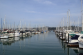
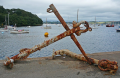
The Anchorages layer is a static data layer. Anchorages are polygons, i.e., geometric shapes that you can draw in, edit
3 KB (464 words) - 09:10, 19 December 2023
| header1 = Layer Info
2 KB (314 words) - 10:00, 1 April 2021
| label2 = Utilizing Layer | data2 = [[{{PARENTPAGES}}|{{PAGENAME:{{PARENTPAGES}}}}]]
442 bytes (49 words) - 15:05, 16 June 2021
| label2 = Utilizing Layer | data2 = [[{{PARENTPAGES}}|{{PAGENAME:{{PARENTPAGES}}}}]]
431 bytes (49 words) - 11:40, 6 October 2021
| label2 = Utilizing Layer | data2 = [[{{PARENTPAGES}}|{{PAGENAME:{{PARENTPAGES}}}}]]
453 bytes (51 words) - 15:37, 10 June 2021
| label2 = Utilizing Layer | data2 = [[{{PARENTPAGES}}|{{PAGENAME:{{PARENTPAGES}}}}]]
430 bytes (49 words) - 11:37, 6 October 2021
| label2 = Utilizing Layer | data2 = [[{{PARENTPAGES}}|{{PAGENAME:{{PARENTPAGES}}}}]]
424 bytes (48 words) - 15:35, 10 June 2021
| header1 = Layer Info
Dolphins is a month-by-month, computer generated data layer following calculations made by the ecosystem simulation (EwE).
3 KB (402 words) - 11:24, 3 October 2023
| header1 = Layer Info
Sediments is a static data layer, providing useful information for planning different human activities, e.g.
2 KB (227 words) - 14:29, 6 April 2021
| label2 = Utilizing Layer | data2 = [[{{PARENTPAGES}}|{{PAGENAME:{{PARENTPAGES}}}}]]
441 bytes (49 words) - 15:05, 16 June 2021
| label2 = Utilizing Layer | data2 = [[{{PARENTPAGES}}|{{PAGENAME:{{PARENTPAGES}}}}]]
424 bytes (48 words) - 11:40, 6 October 2021
| label2 = Utilizing Layer | data2 = [[{{PARENTPAGES}}|{{PAGENAME:{{PARENTPAGES}}}}]]
427 bytes (48 words) - 15:37, 10 June 2021
| label2 = Utilizing Layer | data2 = [[{{PARENTPAGES}}|{{PAGENAME:{{PARENTPAGES}}}}]]
433 bytes (48 words) - 11:37, 6 October 2021
| header1 = Layer Info
...er only exists in the NorthSea Digitwin edition for planning purposes (the layer is empty).
2 KB (307 words) - 13:36, 4 April 2023
| header1 = Layer Info
| header10 = Layer
798 bytes (92 words) - 14:29, 6 April 2021
| header1 = Layer Info
...[[(NS)Ferry Intensity|ferry]] intensity heat maps together. Therefore this layer provides a complete overview of all simulated ship traffic within as well a
2 KB (318 words) - 20:09, 17 November 2020
| label2 = Utilizing Layer | data2 = [[{{PARENTPAGES}}|{{PAGENAME:{{PARENTPAGES}}}}]]
430 bytes (49 words) - 15:06, 16 June 2021
| label2 = Utilizing Layer | data2 = [[{{PARENTPAGES}}|{{PAGENAME:{{PARENTPAGES}}}}]]
428 bytes (48 words) - 11:40, 6 October 2021
| label2 = Utilizing Layer | data2 = [[{{PARENTPAGES}}|{{PAGENAME:{{PARENTPAGES}}}}]]
430 bytes (49 words) - 15:37, 10 June 2021
| label2 = Utilizing Layer | data2 = [[{{PARENTPAGES}}|{{PAGENAME:{{PARENTPAGES}}}}]]
430 bytes (48 words) - 11:38, 6 October 2021
| header1 = Layer Info
| header10 = Layer
798 bytes (92 words) - 14:29, 6 April 2021
| header1 = Layer Info
| header10 = Layer
804 bytes (96 words) - 20:38, 17 November 2020
| label2 = Utilizing Layer | data2 = [[{{PARENTPAGES}}|{{PAGENAME:{{PARENTPAGES}}}}]]
450 bytes (49 words) - 15:06, 16 June 2021
| header1 = Layer Info
| header10 = Utilizing Layer
8 KB (1,321 words) - 09:46, 15 November 2023
| label2 = Utilizing Layer | data2 = [[{{PARENTPAGES}}|{{PAGENAME:{{PARENTPAGES}}}}]]
437 bytes (50 words) - 15:38, 10 June 2021
| label2 = Utilizing Layer | data2 = [[{{PARENTPAGES}}|{{PAGENAME:{{PARENTPAGES}}}}]]
425 bytes (48 words) - 11:38, 6 October 2021
| header1 = Layer Info
589 bytes (67 words) - 13:40, 6 April 2021
| header1 = Layer Info
3 KB (446 words) - 20:08, 17 November 2020
| label2 = Utilizing Layer | data2 = [[{{PARENTPAGES}}|{{PAGENAME:{{PARENTPAGES}}}}]]
428 bytes (50 words) - 15:07, 16 June 2021
| header1 = Layer Info
Passive demersal catch is a month-by-month, computer-generated data layer following this fleet's fishing catch calculated by the ecosystem simulation
3 KB (462 words) - 13:28, 3 April 2023
| label2 = Utilizing Layer | data2 = [[{{PARENTPAGES}}|{{PAGENAME:{{PARENTPAGES}}}}]]
430 bytes (49 words) - 15:03, 16 June 2021
| label2 = Utilizing Layer | data2 = [[{{PARENTPAGES}}|{{PAGENAME:{{PARENTPAGES}}}}]]
427 bytes (48 words) - 11:38, 6 October 2021
| label2 = Utilizing Layer | data2 = [[{{PARENTPAGES}}|{{PAGENAME:{{PARENTPAGES}}}}]]
433 bytes (50 words) - 15:34, 10 June 2021
| header1 = Layer Info
| header10 = Layer
804 bytes (96 words) - 20:37, 17 November 2020
| label2 = Utilizing Layer | data2 = [[{{PARENTPAGES}}|{{PAGENAME:{{PARENTPAGES}}}}]]
445 bytes (51 words) - 15:04, 16 June 2021
| label2 = Utilizing Layer | data2 = [[{{PARENTPAGES}}|{{PAGENAME:{{PARENTPAGES}}}}]]
427 bytes (48 words) - 11:39, 6 October 2021
| label2 = Utilizing Layer | data2 = [[{{PARENTPAGES}}|{{PAGENAME:{{PARENTPAGES}}}}]]
428 bytes (48 words) - 15:36, 10 June 2021
| label2 = Utilizing Layer | data2 = [[{{PARENTPAGES}}|{{PAGENAME:{{PARENTPAGES}}}}]]
424 bytes (48 words) - 15:08, 16 June 2021
| header1 = Layer Info
Here you can add information about how the layer is implemented or used in the MSP Challenge
2 KB (266 words) - 10:02, 20 July 2021
| header1 = Layer Info
607 bytes (69 words) - 20:08, 17 November 2020
| label2 = Utilizing Layer | data2 = [[{{PARENTPAGES}}|{{PAGENAME:{{PARENTPAGES}}}}]]
430 bytes (48 words) - 15:04, 16 June 2021
| label2 = Utilizing Layer | data2 = [[{{PARENTPAGES}}|{{PAGENAME:{{PARENTPAGES}}}}]]
434 bytes (49 words) - 11:39, 6 October 2021
| label2 = Utilizing Layer | data2 = [[{{PARENTPAGES}}|{{PAGENAME:{{PARENTPAGES}}}}]]
466 bytes (53 words) - 15:05, 16 June 2021
| label2 = Utilizing Layer | data2 = [[{{PARENTPAGES}}|{{PAGENAME:{{PARENTPAGES}}}}]]
431 bytes (49 words) - 11:39, 6 October 2021
| header1 = Layer Info
Here you can add information about how the layer is implemented or used in the MSP Challenge
804 bytes (94 words) - 12:17, 26 August 2021
| label2 = Utilizing Layer | data2 = [[{{PARENTPAGES}}|{{PAGENAME:{{PARENTPAGES}}}}]]
427 bytes (48 words) - 11:37, 6 October 2021
| header1 = Layer Info
Here you can add information about how the layer is implemented or used in the MSP Challenge
760 bytes (89 words) - 15:35, 10 June 2021
| header1 = Layer Info
Electricity Cables is a static data layer. They are point-by-point lines that you can draw in, edit or remove when ma
5 KB (672 words) - 15:20, 3 April 2023
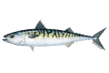
| header1 = Data Layer Info
Mackerel is a month-by-month, computer generated data layer following calculations made by the ecosystem simulation (EwE).
2 KB (287 words) - 09:41, 1 April 2021
| label2 = Utilizing Layer | data2 = [[{{PARENTPAGES}}|{{PAGENAME:{{PARENTPAGES}}}}]]
435 bytes (49 words) - 15:05, 16 June 2021
| label2 = Utilizing Layer | data2 = [[{{PARENTPAGES}}|{{PAGENAME:{{PARENTPAGES}}}}]]
424 bytes (48 words) - 11:40, 6 October 2021
| header1 = Layer Info
Here you can add information about how the layer is implemented or used in the MSP Challenge
2 KB (258 words) - 13:53, 26 August 2021
| header1 = Layer Info
Here you can add information about how the layer is implemented or used in the MSP Challenge
1 KB (180 words) - 11:37, 6 October 2021
| label2 = Utilizing Layer | data2 = [[{{PARENTPAGES}}|{{PAGENAME:{{PARENTPAGES}}}}]]
428 bytes (48 words) - 15:36, 10 June 2021
| header1 = Layer Info
Not applicable. This data layer is not available in the Baltic Sea Edition.
1 KB (176 words) - 15:08, 27 March 2024
| header1 = Layer Info
598 bytes (70 words) - 09:42, 1 April 2021
| label2 = Utilizing Layer | data2 = [[{{PARENTPAGES}}|{{PAGENAME:{{PARENTPAGES}}}}]]
434 bytes (49 words) - 15:05, 16 June 2021
| label2 = Utilizing Layer | data2 = [[{{PARENTPAGES}}|{{PAGENAME:{{PARENTPAGES}}}}]]
428 bytes (48 words) - 11:40, 6 October 2021
| label2 = Utilizing Layer | data2 = [[{{PARENTPAGES}}|{{PAGENAME:{{PARENTPAGES}}}}]]
424 bytes (48 words) - 15:37, 10 June 2021
| label2 = Utilizing Layer | data2 = [[{{PARENTPAGES}}|{{PAGENAME:{{PARENTPAGES}}}}]]
426 bytes (48 words) - 11:37, 6 October 2021
| header1 = Layer Info
Cod is a month-by-month, computer generated data layer following calculations made by the ecosystem simulation (EwE). For more inf
7 KB (1,108 words) - 14:25, 14 May 2024
| header1 = Layer Info
| header10 = Layer
798 bytes (92 words) - 14:29, 6 April 2021
| header1 = Layer Info
'''IN THIS TAB MAIN INFO ABOUT THE LAYER IS PLACED'''
840 bytes (102 words) - 20:09, 17 November 2020
| header1 = Layer Info
Here you can add information about how the layer is implemented or used in the MSP Challenge
2 KB (248 words) - 15:06, 16 June 2021
| label2 = Utilizing Layer | data2 = [[{{PARENTPAGES}}|{{PAGENAME:{{PARENTPAGES}}}}]]
427 bytes (48 words) - 11:40, 6 October 2021
| label2 = Utilizing Layer | data2 = [[{{PARENTPAGES}}|{{PAGENAME:{{PARENTPAGES}}}}]]
433 bytes (49 words) - 15:38, 10 June 2021
| label2 = Utilizing Layer | data2 = [[{{PARENTPAGES}}|{{PAGENAME:{{PARENTPAGES}}}}]]
438 bytes (49 words) - 11:38, 6 October 2021
If you want to add a new layer to the knowledge base, this page should contain the main information that y
The infobox provides an overview into important details of a layer. You can double click on the InfoBox to view its properties and change the
2 KB (386 words) - 09:20, 31 March 2021
| header1 = Layer Info
| header10 = Layer
796 bytes (96 words) - 20:37, 17 November 2020
| label2 = Utilizing Layer | data2 = [[{{PARENTPAGES}}|{{PAGENAME:{{PARENTPAGES}}}}]]
428 bytes (49 words) - 15:06, 16 June 2021
| header1 = Layer Info
The wind speed layer is static; users can consult it, for instance, to optimise wind energy prod
6 KB (845 words) - 12:33, 16 May 2024
| label2 = Utilizing Layer | data2 = [[{{PARENTPAGES}}|{{PAGENAME:{{PARENTPAGES}}}}]]
432 bytes (49 words) - 15:38, 10 June 2021
| label2 = Utilizing Layer | data2 = [[{{PARENTPAGES}}|{{PAGENAME:{{PARENTPAGES}}}}]]
524 bytes (60 words) - 11:38, 6 October 2021
| label2 = Utilizing Layer | data2 = [[{{PARENTPAGES}}|{{PAGENAME:{{PARENTPAGES}}}}]]
425 bytes (48 words) - 15:34, 10 June 2021
| header1 = Layer Info
2 KB (275 words) - 20:09, 17 November 2020
| label2 = Utilizing Layer | data2 = [[{{PARENTPAGES}}|{{PAGENAME:{{PARENTPAGES}}}}]]
428 bytes (50 words) - 15:07, 16 June 2021
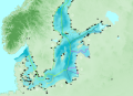
| header1 = Layer Info
Data layer implemented as provided by project partners, assuming the routes are applic
5 KB (711 words) - 10:06, 3 October 2023
| label2 = Utilizing Layer | data2 = [[{{PARENTPAGES}}|{{PAGENAME:{{PARENTPAGES}}}}]]
425 bytes (48 words) - 15:04, 16 June 2021
| header1 = Layer Info
Here you can add information about how the layer is implemented or used in the MSP Challenge
1 KB (182 words) - 11:39, 6 October 2021
| label2 = Utilizing Layer | data2 = [[{{PARENTPAGES}}|{{PAGENAME:{{PARENTPAGES}}}}]]
424 bytes (48 words) - 15:07, 16 June 2021
| header1 = Layer Info
This layer is for visualization purposes only.
3 KB (348 words) - 09:36, 20 July 2021
| header1 = Layer Info
| header10 = Layer
778 bytes (94 words) - 20:38, 17 November 2020
| label2 = Utilizing Layer | data2 = [[{{PARENTPAGES}}|{{PAGENAME:{{PARENTPAGES}}}}]]
428 bytes (48 words) - 15:04, 16 June 2021
| label2 = Utilizing Layer | data2 = [[{{PARENTPAGES}}|{{PAGENAME:{{PARENTPAGES}}}}]]
434 bytes (49 words) - 11:39, 6 October 2021
| label2 = Utilizing Layer | data2 = [[{{PARENTPAGES}}|{{PAGENAME:{{PARENTPAGES}}}}]]
445 bytes (51 words) - 15:36, 10 June 2021
| header1 = Layer Info
Here you can add information about how the layer is implemented or used in the MSP Challenge
1 KB (181 words) - 11:36, 6 October 2021
| label2 = Utilizing Layer | data2 = [[{{PARENTPAGES}}|{{PAGENAME:{{PARENTPAGES}}}}]]
428 bytes (48 words) - 15:35, 10 June 2021
| header1 = Layer Info
1 KB (145 words) - 20:08, 17 November 2020
| header1 = Layer Info
Benthic invertebrates is a month-by-month, computer generated data layer following calculations made by the ecosystem simulation (EwE).
1 KB (178 words) - 09:40, 1 April 2021
| label2 = Utilizing Layer | data2 = [[{{PARENTPAGES}}|{{PAGENAME:{{PARENTPAGES}}}}]]
435 bytes (49 words) - 15:05, 16 June 2021
| label2 = Utilizing Layer | data2 = [[{{PARENTPAGES}}|{{PAGENAME:{{PARENTPAGES}}}}]]
424 bytes (48 words) - 11:39, 6 October 2021
| label2 = Utilizing Layer | data2 = [[{{PARENTPAGES}}|{{PAGENAME:{{PARENTPAGES}}}}]]
427 bytes (48 words) - 15:36, 10 June 2021
| label2 = Utilizing Layer | data2 = [[{{PARENTPAGES}}|{{PAGENAME:{{PARENTPAGES}}}}]]
430 bytes (49 words) - 11:37, 6 October 2021
| label2 = Utilizing Layer | data2 = [[{{PARENTPAGES}}|{{PAGENAME:{{PARENTPAGES}}}}]]
428 bytes (48 words) - 15:35, 10 June 2021
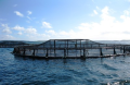
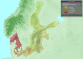
| header1 = Layer Info
...th Sea region, within 10km from the coast and within 2km from a river. The layer was styled according to the Farm Type attribute and the farm types "mixed (
6 KB (811 words) - 07:15, 4 April 2023
| header1 = Layer Info
The Pipelines layer is a static data layer. Pipelines are point-by-point lines that you can draw in, edit or remove wh
2 KB (229 words) - 09:41, 1 April 2021
| label2 = Utilizing Layer | data2 = [[{{PARENTPAGES}}|{{PAGENAME:{{PARENTPAGES}}}}]]
443 bytes (49 words) - 15:05, 16 June 2021
| label2 = Utilizing Layer | data2 = [[{{PARENTPAGES}}|{{PAGENAME:{{PARENTPAGES}}}}]]
428 bytes (48 words) - 11:40, 6 October 2021
| label2 = Utilizing Layer | data2 = [[{{PARENTPAGES}}|{{PAGENAME:{{PARENTPAGES}}}}]]
437 bytes (49 words) - 15:37, 10 June 2021
| label2 = Utilizing Layer | data2 = [[{{PARENTPAGES}}|{{PAGENAME:{{PARENTPAGES}}}}]]
424 bytes (48 words) - 11:37, 6 October 2021
| label2 = Utilizing Layer | data2 = [[{{PARENTPAGES}}|{{PAGENAME:{{PARENTPAGES}}}}]]
427 bytes (48 words) - 15:36, 10 June 2021
| header1 = Layer Info
The layer was reprojected to Lambert Azimuthal Equal Area (EPSG:3035). The geometries
4 KB (525 words) - 12:49, 4 April 2023
| header1 = Layer Info
| header10 = Layer
798 bytes (92 words) - 14:29, 6 April 2021
| header1 = Layer Info
Cities is a static data layer. Obviously not all cities are included; only the largest, major cities are
3 KB (407 words) - 13:47, 16 May 2024
| label2 = Utilizing Layer | data2 = [[{{PARENTPAGES}}|{{PAGENAME:{{PARENTPAGES}}}}]]
432 bytes (48 words) - 15:06, 16 June 2021
| label2 = Utilizing Layer | data2 = [[{{PARENTPAGES}}|{{PAGENAME:{{PARENTPAGES}}}}]]
427 bytes (48 words) - 11:40, 6 October 2021
| label2 = Utilizing Layer | data2 = [[{{PARENTPAGES}}|{{PAGENAME:{{PARENTPAGES}}}}]]
429 bytes (49 words) - 15:37, 10 June 2021
| label2 = Utilizing Layer | data2 = [[{{PARENTPAGES}}|{{PAGENAME:{{PARENTPAGES}}}}]]
425 bytes (47 words) - 11:38, 6 October 2021
| header1 = Layer Info
Not applicable. This layer is not yet available in the MSP Challenge North Sea Edition.
3 KB (454 words) - 15:57, 19 December 2023
| header1 = Layer Info
| header10 = Layer
798 bytes (92 words) - 14:29, 6 April 2021
| header1 = Layer Info
Fossil Fuel Availability is a static data layer representing general/rough indications of oil and gas fields as far as we k
1 KB (168 words) - 20:09, 17 November 2020
| label2 = Utilizing Layer | data2 = [[{{PARENTPAGES}}|{{PAGENAME:{{PARENTPAGES}}}}]]
434 bytes (49 words) - 15:06, 16 June 2021
| header1 = Layer Info
| header10 = Layer
506 bytes (56 words) - 16:11, 11 January 2022
| label2 = Utilizing Layer | data2 = [[{{PARENTPAGES}}|{{PAGENAME:{{PARENTPAGES}}}}]]
435 bytes (49 words) - 15:38, 10 June 2021
| label2 = Utilizing Layer | data2 = [[{{PARENTPAGES}}|{{PAGENAME:{{PARENTPAGES}}}}]]
428 bytes (48 words) - 11:38, 6 October 2021
| header1 = Layer Info
953 bytes (119 words) - 13:40, 6 April 2021
| header1 = Layer Info
Noise is a month-by-month computer generated data layer, based on any of the following human activities:
1 KB (138 words) - 20:09, 17 November 2020
| header1 = Layer Info
Here you can add information about how the layer is implemented or used in the MSP Challenge
1 KB (163 words) - 15:07, 16 June 2021
| header1 = Layer Info
The maritime compartments layer reflects legal political and administrative boundaries.
1 KB (203 words) - 12:25, 3 April 2023
| header1 = Layer Info
Here you can add information about how the layer is implemented or used in the MSP Challenge
1 KB (189 words) - 15:03, 16 June 2021
| header1 = Layer Info
Here you can add information about how the layer is implemented or used in the MSP Challenge
1 KB (183 words) - 11:38, 6 October 2021
| label2 = Utilizing Layer | data2 = [[{{PARENTPAGES}}|{{PAGENAME:{{PARENTPAGES}}}}]]
434 bytes (50 words) - 15:34, 10 June 2021
| header1 = Layer Info
'''IN THIS TAB MAIN INFO ABOUT THE LAYER IS PLACED'''
837 bytes (101 words) - 20:09, 17 November 2020
| header1 = Layer Info
Here you can add information about how the layer is implemented or used in the MSP Challenge
1 KB (194 words) - 15:07, 16 June 2021
| header1 = Layer Info
Here you can add information about how the layer is implemented or used in the MSP Challenge
1 KB (159 words) - 15:04, 16 June 2021
| label2 = Utilizing Layer | data2 = [[{{PARENTPAGES}}|{{PAGENAME:{{PARENTPAGES}}}}]]
431 bytes (49 words) - 11:39, 6 October 2021
| label2 = Utilizing Layer | data2 = [[{{PARENTPAGES}}|{{PAGENAME:{{PARENTPAGES}}}}]]
428 bytes (48 words) - 15:07, 16 June 2021
| label2 = Utilizing Layer | data2 = [[{{PARENTPAGES}}|{{PAGENAME:{{PARENTPAGES}}}}]]
426 bytes (48 words) - 15:35, 10 June 2021
| header1 = Layer Info
| header10 = Layer
917 bytes (115 words) - 20:38, 17 November 2020
| label2 = Utilizing Layer | data2 = [[{{PARENTPAGES}}|{{PAGENAME:{{PARENTPAGES}}}}]]
425 bytes (48 words) - 15:04, 16 June 2021
| label2 = Utilizing Layer | data2 = [[{{PARENTPAGES}}|{{PAGENAME:{{PARENTPAGES}}}}]]
431 bytes (49 words) - 11:39, 6 October 2021
| label2 = Utilizing Layer | data2 = [[{{PARENTPAGES}}|{{PAGENAME:{{PARENTPAGES}}}}]]
438 bytes (49 words) - 15:36, 10 June 2021
| label2 = Utilizing Layer | data2 = [[{{PARENTPAGES}}|{{PAGENAME:{{PARENTPAGES}}}}]]
424 bytes (48 words) - 11:36, 6 October 2021
| label2 = Utilizing Layer | data2 = [[{{PARENTPAGES}}|{{PAGENAME:{{PARENTPAGES}}}}]]
467 bytes (54 words) - 15:35, 10 June 2021
| header1 = Layer Info
Passenger Intensity is a month-by-month, computer generated data layer showing a 'heat map' of main passenger cruise line traffic. The shipping si
3 KB (427 words) - 14:43, 3 April 2023
| label2 = Utilizing Layer | data2 = [[{{PARENTPAGES}}|{{PAGENAME:{{PARENTPAGES}}}}]]
425 bytes (47 words) - 15:36, 10 June 2021
| label2 = Utilizing Layer | data2 = [[{{PARENTPAGES}}|{{PAGENAME:{{PARENTPAGES}}}}]]
424 bytes (48 words) - 11:37, 6 October 2021
| header1 = Layer Info
Here you can add information about how the layer is implemented or used in the MSP Challenge
1 KB (118 words) - 15:35, 10 June 2021
| header1 = Layer Info
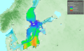
The data layer was clipped to the North Sea Region.
3 KB (372 words) - 14:30, 3 April 2023
| header1 = Layer Info
'''IN THIS TAB MAIN INFO ABOUT THE LAYER IS PLACED'''
801 bytes (97 words) - 09:40, 1 April 2021
| label2 = Utilizing Layer | data2 = [[{{PARENTPAGES}}|{{PAGENAME:{{PARENTPAGES}}}}]]
443 bytes (49 words) - 15:05, 16 June 2021
| label2 = Utilizing Layer | data2 = [[{{PARENTPAGES}}|{{PAGENAME:{{PARENTPAGES}}}}]]
428 bytes (48 words) - 11:40, 6 October 2021
| label2 = Utilizing Layer | data2 = [[{{PARENTPAGES}}|{{PAGENAME:{{PARENTPAGES}}}}]]
454 bytes (51 words) - 15:37, 10 June 2021
| header1 = Layer Info
Here you can add information about how the layer is implemented or used in the MSP Challenge
1 KB (180 words) - 11:37, 6 October 2021
| label2 = Utilizing Layer | data2 = [[{{PARENTPAGES}}|{{PAGENAME:{{PARENTPAGES}}}}]]
427 bytes (48 words) - 15:35, 10 June 2021
| header1 = Layer Info
The Bird Watching data layer reflects popular areas for bird watching.
2 KB (206 words) - 07:07, 4 April 2023
| header1 = Layer Info
The Shannon Diversity Indicator a month-by-month, computer generated data layer following calculations made by the ecosystem simulation (EwE).
1 KB (200 words) - 09:41, 1 April 2021
| label2 = Utilizing Layer | data2 = [[{{PARENTPAGES}}|{{PAGENAME:{{PARENTPAGES}}}}]]
433 bytes (48 words) - 15:05, 16 June 2021
| label2 = Utilizing Layer | data2 = [[{{PARENTPAGES}}|{{PAGENAME:{{PARENTPAGES}}}}]]
427 bytes (48 words) - 11:40, 6 October 2021
| label2 = Utilizing Layer | data2 = [[{{PARENTPAGES}}|{{PAGENAME:{{PARENTPAGES}}}}]]
425 bytes (48 words) - 15:37, 10 June 2021
| label2 = Utilizing Layer | data2 = [[{{PARENTPAGES}}|{{PAGENAME:{{PARENTPAGES}}}}]]
431 bytes (48 words) - 11:37, 6 October 2021
| header1 = Layer Info
Cod fisheries closure is a status layer that contributes for the protection agains the fleets that target cod, this
3 KB (426 words) - 13:36, 4 April 2023
| header1 = Layer Info
| header10 = Layer
798 bytes (92 words) - 14:29, 6 April 2021
| header1 = Layer Info
| header10 = Layer
800 bytes (96 words) - 20:38, 17 November 2020
| header1 = Layer Info
Here you can add information about how the layer is implemented or used in the MSP Challenge
1 KB (175 words) - 15:06, 16 June 2021
| header1 = Layer Info
Here you can add information about how the layer is implemented or used in the MSP Challenge
1 KB (185 words) - 11:40, 6 October 2021
| header1 = Layer Info
Here you can add information about how the layer is implemented or used in the MSP Challenge
1 KB (123 words) - 15:37, 10 June 2021
| label2 = Utilizing Layer | data2 = [[{{PARENTPAGES}}|{{PAGENAME:{{PARENTPAGES}}}}]]
430 bytes (48 words) - 11:38, 6 October 2021
| header1 = Layer Info
| header10 = Layer
798 bytes (92 words) - 14:29, 6 April 2021
| header1 = Layer Info
| header10 = Layer
800 bytes (95 words) - 20:38, 17 November 2020
| label2 = Utilizing Layer | data2 = [[{{PARENTPAGES}}|{{PAGENAME:{{PARENTPAGES}}}}]]
452 bytes (49 words) - 15:06, 16 June 2021
| header1 = Layer Info
| header10 = Utilizing Layer
5 KB (735 words) - 09:28, 29 November 2023
| label2 = Utilizing Layer | data2 = [[{{PARENTPAGES}}|{{PAGENAME:{{PARENTPAGES}}}}]]
432 bytes (49 words) - 15:38, 10 June 2021
| label2 = Utilizing Layer | data2 = [[{{PARENTPAGES}}|{{PAGENAME:{{PARENTPAGES}}}}]]
431 bytes (49 words) - 11:38, 6 October 2021
| header10 = Utilizing Layer
531 bytes (67 words) - 08:58, 10 June 2021
| header1 = Layer Info
Cod is a month-by-month, computer generated data layer following calculations made by the ecosystem simulation (EwE).
2 KB (319 words) - 20:03, 17 November 2020
| label2 = Utilizing Layer | data2 = [[{{PARENTPAGES}}|{{PAGENAME:{{PARENTPAGES}}}}]]
428 bytes (50 words) - 15:07, 16 June 2021
| image = [[File:Layer Industrial and Pelagic Trawl.png|200px]]
| header1 = Layer Info
3 KB (457 words) - 13:28, 3 April 2023
| label2 = Utilizing Layer | data2 = [[{{PARENTPAGES}}|{{PAGENAME:{{PARENTPAGES}}}}]]
430 bytes (49 words) - 15:03, 16 June 2021
| label2 = Utilizing Layer | data2 = [[{{PARENTPAGES}}|{{PAGENAME:{{PARENTPAGES}}}}]]
425 bytes (48 words) - 11:38, 6 October 2021
| label2 = Utilizing Layer | data2 = [[{{PARENTPAGES}}|{{PAGENAME:{{PARENTPAGES}}}}]]
425 bytes (48 words) - 15:34, 10 June 2021
| header1 = Layer Info
| header10 = Layer
801 bytes (96 words) - 20:37, 17 November 2020
| label2 = Utilizing Layer | data2 = [[{{PARENTPAGES}}|{{PAGENAME:{{PARENTPAGES}}}}]]
445 bytes (51 words) - 15:04, 16 June 2021
| label2 = Utilizing Layer | data2 = [[{{PARENTPAGES}}|{{PAGENAME:{{PARENTPAGES}}}}]]
425 bytes (48 words) - 11:39, 6 October 2021
| header1 = Layer Info
Here you can add information about how the layer is implemented or used in the MSP Challenge
2 KB (215 words) - 16:12, 16 March 2022
| label2 = Utilizing Layer | data2 = [[{{PARENTPAGES}}|{{PAGENAME:{{PARENTPAGES}}}}]]
427 bytes (48 words) - 15:08, 16 June 2021
| label2 = Utilizing Layer | data2 = [[{{PARENTPAGES}}|{{PAGENAME:{{PARENTPAGES}}}}]]
444 bytes (52 words) - 15:35, 10 June 2021
| header1 = Layer Info
4 KB (552 words) - 20:08, 17 November 2020
| label2 = Utilizing Layer | data2 = [[{{PARENTPAGES}}|{{PAGENAME:{{PARENTPAGES}}}}]]
427 bytes (48 words) - 15:04, 16 June 2021
| label2 = Utilizing Layer | data2 = [[{{PARENTPAGES}}|{{PAGENAME:{{PARENTPAGES}}}}]]
424 bytes (48 words) - 11:39, 6 October 2021
| label2 = Utilizing Layer | data2 = [[{{PARENTPAGES}}|{{PAGENAME:{{PARENTPAGES}}}}]]
445 bytes (50 words) - 15:05, 16 June 2021
| label2 = Utilizing Layer | data2 = [[{{PARENTPAGES}}|{{PAGENAME:{{PARENTPAGES}}}}]]
428 bytes (48 words) - 11:39, 6 October 2021
| header1 = Layer Info
Here you can add information about how the layer is implemented or used in the MSP Challenge
783 bytes (93 words) - 15:36, 10 June 2021
| label2 = Utilizing Layer | data2 = [[{{PARENTPAGES}}|{{PAGENAME:{{PARENTPAGES}}}}]]
428 bytes (48 words) - 11:37, 6 October 2021
| header1 = Layer Info
Here you can add information about how the layer is implemented or used in the MSP Challenge
759 bytes (89 words) - 13:17, 14 March 2022
| header1 = Layer Info
Enter name of the layer at the North Sea source.
2 KB (316 words) - 15:21, 3 April 2023
| header1 = Layer Info
Maintenance Intensity is a month-by-month, computer generated data layer showing a 'heat map' of maintenance ship traffic. The shipping simulation g
1 KB (159 words) - 09:41, 1 April 2021
| label2 = Utilizing Layer | data2 = [[{{PARENTPAGES}}|{{PAGENAME:{{PARENTPAGES}}}}]]
439 bytes (49 words) - 15:05, 16 June 2021
| label2 = Utilizing Layer | data2 = [[{{PARENTPAGES}}|{{PAGENAME:{{PARENTPAGES}}}}]]
427 bytes (48 words) - 11:40, 6 October 2021
| label2 = Utilizing Layer | data2 = [[{{PARENTPAGES}}|{{PAGENAME:{{PARENTPAGES}}}}]]
436 bytes (49 words) - 15:37, 10 June 2021
| label2 = Utilizing Layer | data2 = [[{{PARENTPAGES}}|{{PAGENAME:{{PARENTPAGES}}}}]]
424 bytes (48 words) - 11:37, 6 October 2021
| header1 = Layer Info
Here you can add information about how the layer is implemented or used in the MSP Challenge
1 KB (128 words) - 15:36, 10 June 2021
| header1 = Layer Info
This layer is not present in the Eastern Mediterranean Sea.<headertabs/>
1 KB (172 words) - 15:07, 27 March 2024
| header1 = Layer Info
Wave Height is a static data layer, providing useful information for planning different human activities, e.g.
1 KB (162 words) - 09:42, 1 April 2021
| label2 = Utilizing Layer | data2 = [[{{PARENTPAGES}}|{{PAGENAME:{{PARENTPAGES}}}}]]
431 bytes (48 words) - 15:05, 16 June 2021
| header1 = Layer Info
Here you can add information about how the layer is implemented or used in the MSP Challenge
1 KB (184 words) - 11:40, 6 October 2021
| label2 = Utilizing Layer | data2 = [[{{PARENTPAGES}}|{{PAGENAME:{{PARENTPAGES}}}}]]
427 bytes (48 words) - 15:37, 10 June 2021
| label2 = Utilizing Layer | data2 = [[{{PARENTPAGES}}|{{PAGENAME:{{PARENTPAGES}}}}]]
433 bytes (48 words) - 11:37, 6 October 2021
| header1 = Layer Info
Demersal fish is a month-by-month, computer generated data layer following calculations made by the ecosystem simulation (EwE). For more in
5 KB (703 words) - 13:12, 11 October 2023
| header1 = Layer Info
| header10 = Layer
798 bytes (92 words) - 14:29, 6 April 2021
| header1 = Layer Info
2 KB (316 words) - 08:15, 18 November 2020
| label2 = Utilizing Layer | data2 = [[{{PARENTPAGES}}|{{PAGENAME:{{PARENTPAGES}}}}]]
442 bytes (49 words) - 15:06, 16 June 2021
| label2 = Utilizing Layer | data2 = [[{{PARENTPAGES}}|{{PAGENAME:{{PARENTPAGES}}}}]]
425 bytes (48 words) - 11:40, 6 October 2021
| label2 = Utilizing Layer | data2 = [[{{PARENTPAGES}}|{{PAGENAME:{{PARENTPAGES}}}}]]
438 bytes (50 words) - 15:38, 10 June 2021
| label2 = Utilizing Layer | data2 = [[{{PARENTPAGES}}|{{PAGENAME:{{PARENTPAGES}}}}]]
438 bytes (49 words) - 11:38, 6 October 2021
| header1 = Layer Info
1 KB (151 words) - 08:20, 20 July 2021
| header1 = Layer Info
| header10 = Layer
1,014 bytes (128 words) - 20:38, 17 November 2020
| header1 = Layer Info
Here you can add information about how the layer is implemented or used in the MSP Challenge
2 KB (199 words) - 15:06, 16 June 2021
| header1 = Layer Info
Wave Height is a static data layer, providing useful information for planning different human activities, e.g.
3 KB (386 words) - 12:38, 16 May 2024
| label2 = Utilizing Layer | data2 = [[{{PARENTPAGES}}|{{PAGENAME:{{PARENTPAGES}}}}]]
435 bytes (49 words) - 15:38, 10 June 2021
| label2 = Utilizing Layer | data2 = [[{{PARENTPAGES}}|{{PAGENAME:{{PARENTPAGES}}}}]]
439 bytes (49 words) - 11:38, 6 October 2021
| label2 = Utilizing Layer | data2 = [[{{PARENTPAGES}}|{{PAGENAME:{{PARENTPAGES}}}}]]
427 bytes (48 words) - 15:34, 10 June 2021
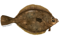
| header1 = Layer Info
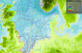
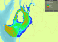
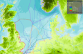
Bottom Trawl Catch is a month-by-month, computer generated data layer following this fleet's fishing efforts calculated by the ecosystem simulati
2 KB (303 words) - 20:08, 17 November 2020
| label2 = Utilizing Layer | data2 = [[{{PARENTPAGES}}|{{PAGENAME:{{PARENTPAGES}}}}]]
428 bytes (50 words) - 15:07, 16 June 2021
| header1 = Layer Info
...t to Lambert Azimuthal Equal Area (EPSG:3035). Extracted features from the layer that covered the sea area and simplified extracted features.
3 KB (447 words) - 12:35, 19 December 2023
| label2 = Utilizing Layer | data2 = [[{{PARENTPAGES}}|{{PAGENAME:{{PARENTPAGES}}}}]]
427 bytes (48 words) - 15:04, 16 June 2021
| label2 = Utilizing Layer | data2 = [[{{PARENTPAGES}}|{{PAGENAME:{{PARENTPAGES}}}}]]
434 bytes (49 words) - 11:39, 6 October 2021
| label2 = Utilizing Layer | data2 = [[{{PARENTPAGES}}|{{PAGENAME:{{PARENTPAGES}}}}]]
427 bytes (48 words) - 15:07, 16 June 2021
| label2 = Utilizing Layer | data2 = [[{{PARENTPAGES}}|{{PAGENAME:{{PARENTPAGES}}}}]]
426 bytes (48 words) - 15:34, 10 June 2021
| header1 = Layer Info
| header10 = Layer
783 bytes (93 words) - 20:37, 17 November 2020
| header1 = Layer Info
Here you can add information about how the layer is implemented or used in the MSP Challenge
1 KB (178 words) - 15:04, 16 June 2021
| label2 = Utilizing Layer | data2 = [[{{PARENTPAGES}}|{{PAGENAME:{{PARENTPAGES}}}}]]
424 bytes (48 words) - 11:39, 6 October 2021
| label2 = Utilizing Layer | data2 = [[{{PARENTPAGES}}|{{PAGENAME:{{PARENTPAGES}}}}]]
445 bytes (51 words) - 15:36, 10 June 2021


.png)
.png)
.png)

 Co-funded by the European Union.